Showers and thunderstorms are likely this afternoon and evening, with widespread rain chances in the forecast through Thursday.
What You Need To Know
- Rounds of storms tonight through Thursday
- Heavy rain is likely across the state
- Severe storms are possible with gusty winds, hail and localized flooding
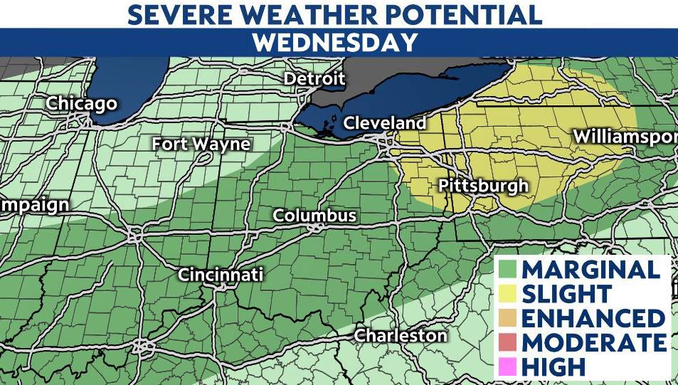
Most of the state is currently under a Marginal Risk (Level 1/5) for severe storms, with parts of Northeast Ohio under a Slight Risk (2/5). Severe weather will be isolated, but cannot be ruled out. There will be a threat for straight-line winds, hail, and even an isolated tornado.

Additionally, with rounds of heavy rain falling through the day Thursday, the chance is there for localized flooding, with some parts of the state seeing over 2″ of rain.
We’re drier and cooler Friday, with highs back in the 60s. The brief cold snap won’t stick around long and we’re back in the 70s this weekend.
Severe Weather Threat
Thunderstorms are likely, a few of which could be strong to severe.
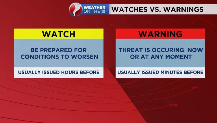
A watch is issued when severe weather is POSSIBLE. A warning is issued when severe weather is IMMINENT.