After a wintry weekend, temperatures will moderate as we head into the middle of next week.
What You Need To Know
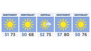
- Most areas dry out a bit on Monday across Ohio
- A warm front lifts north Tuesday and Wednesday
- Scattered showers and highs in the 60s are in store for Wednesday
- Rain, snow and much colder air return late in the week
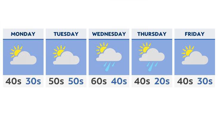
Monday will start off dry, after rain and snow Sunday, as high-pressure inches a bit closer over Tennessee. There will be a little lift in the atmosphere over northeast Ohio, which could bring a few areas along the lakeshore a few rain and snow showers late Monday night. We’re expecting little, if any accumulation.
Meanwhile, Tuesday looks a lot milder for most of the state, with increasing sunshine as well. A warm front will lift north, setting us up for 60s across much of Ohio on Wednesday.
Along with this, expect a few mid-week showers as the corresponding cold front moves in. With temperatures holding steady in the mid-60s, any precipitation at this point will just fall in the form of plain old rain.
Colder air is once again poised to return late in the week and into next weekend, with a few rain and even snow showers expected late Thursday and into Friday.