OHIO — With below average temperatures and no major storms systems in the forecast, the week ahead is shaping up to be rather comfortable for the Buckeye State.
What You Need To Know
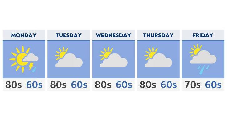
- Monday showers move east and out
- Temperatures remain below average
- Highs: Mainly in the 70s and low 80s
- Unsettled weather returns by next weekend
The unsettled weekend weather does spill over a bit into Monday, with a few scattered showers and sprinkles exiting by late Monday evening. Severe weather is not expected, and most of the rain will remain scattered and light.
Tuesday does start off cloudy and cool, although we’ll gradually see a bit of sun sneaking in by the end of the day.
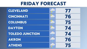
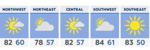
For most of the week, temperatures will remain a bit below average, mainly in the upper 70s to the north, and the lower 80s for central and southern Ohio. There isn’t much of a chance in the forecast through at least Friday.
By the end of the week, temperatures will inch up a little closer, with a few more clouds rolling in.
Our next system approaches by Saturday, which gives next week the better chance for a few showers and maybe even a few thunderstorms.