OHIO — With near-to-above average temperatures and no major storms systems in the forecast, the week ahead is shaping up to be a rather nice last full week of August for the Buckeye State.
What You Need To Know
- Showers wind down Monday night
- Temperatures push above average
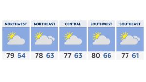
- Highs: Mainly low-to-mid 80s
- Unsettled weather returns by next weekend
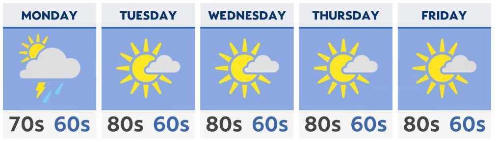
The stormy weekend weather does spill over a bit into Monday, with a few scattered showers and thunderstorms exiting by Monday night. Severe weather is not expected, and most of the rain will remain scattered and light.
Sunshine and dry weather will return Tuesday, although a few rain showers will be possible in far northeast Ohio early in the day.
For most of the week, temperatures will remain at or just above average, mainly in the lower 80s to the north, and the middle 80s for central and southern Ohio.
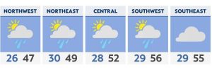
By the end of the week, temperatures may reach the upper 80s in a few locations, with a few more clouds rolling in.
Our next system approaches by Saturday, which brings the chance for a few showers and thunderstorms into next weekend.