Winter Storm Warnings are in effect ahead of a dangerous winter weather system that moves into Ohio tonight.
If you have travel plans and you can get where you need to be today, that’s your best bet to avoid significant travel delays.
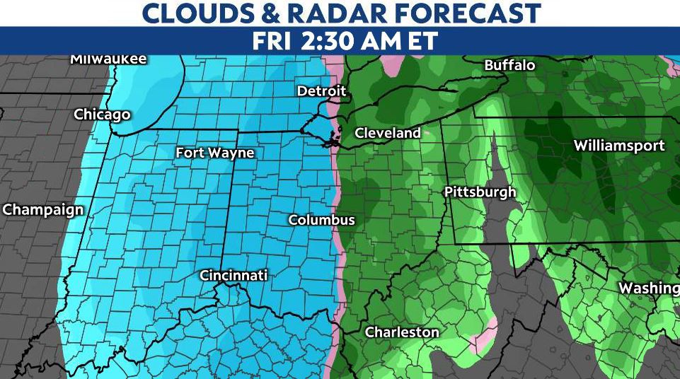
A strong cold front moves in tonight, quickly changing rain to snow. Because of a quick drop in temperatures by 30 degrees or so, flash freezing will be a concern, leading to treacherous conditions on the roads.

In addition to brutal cold, strong winds will lead to power outages and dangerously cold wind chills. Plan on wind chills tomorrow to be around -20 to -30.

Temperatures themselves Friday will be down in the single digits, if not below zero.
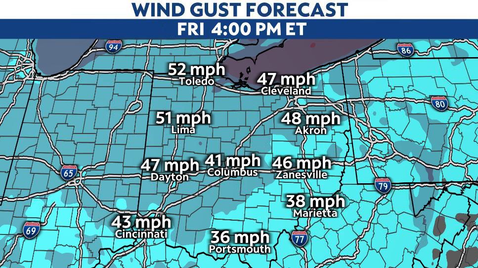
Powerful winds
Winds will increase out of the south-southeast on Thursday night ahead of the cold front. Once the front passes, strong west-northwest winds will begin to howl. Wind gusts may hit 40 to 50 mph overnight and through much of Friday.
Wind gusts may approach 60 mph at times, especially in northern Ohio.
Strong winds, coupled with some heavy bursts of snow, could lead to near-blizzard conditions at times.
Snow totals
Overall, the highest totals will focus on northern Ohio, with amounts dropping a bit farther to the south.
Still, we can expect widespread areas seeing 3-6″ of snow from this system, much of that falling in just a few hours.

Higher amounts are likely through Saturday for the Snowbelt, where areas of 8 inches or more are possible.