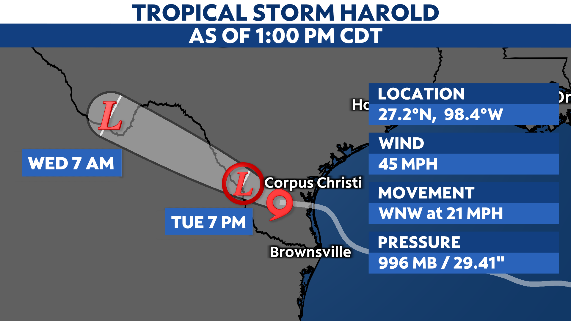
After making landfall over Padre Island on Tuesday morning, Tropical Storm Harold continues to track farther west across South Texas, bringing heavy rain and gusty winds.
Previously Tropical Depression Nine, Harold became the eighth named storm of the 2023 Atlantic hurricane season at 1 a.m. CT on Aug. 22.
It made landfall over Padre Island, Texas on Tuesday morning, but has since moved farther west. Harold is currently about 20 miles east-southeast of Hebbronville, Texas, producing maximum sustained wind speeds of 45 mph.

Heavy rain and gusty winds from Harold will continue to spread farther inland, eventually moving into West Texas by Wednesday morning.
Some showers and storms could make it into Central Texas, but again, most of the rain will stay confined to southern Texas.
Tropical Storm Warnings remain in effect along the Texas coast from the mouth of the Rio Grande to Port O’Connor, with Tropical Storm Watches in effect from Port O’Connor to Sargent.

Along with tropical storm conditions, Harold could also generate a few brief tornadoes and hazardous marine conditions, including large swells and life-threatening surf and rip currents.
We’re also monitoring Tropical Storm Franklin in the Atlantic, along with two other disturbances with the potential to develop. Check here for a look at the 2023 Atlantic hurricane season so far.
Our team of meteorologists dives deep into the science of weather and breaks down timely weather data and information. To view more weather and climate stories, check out our weather blogs section.