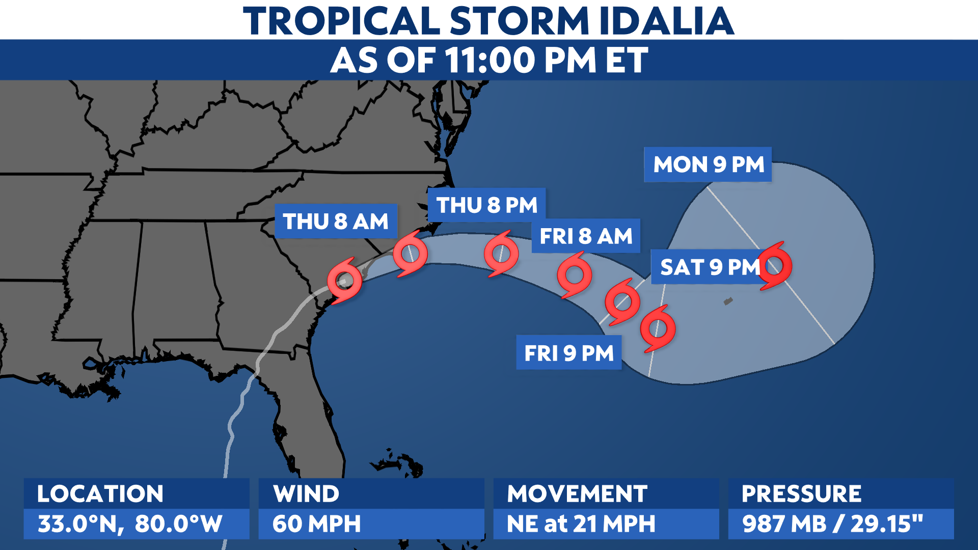
Idalia is now a tropical storm as it moves through the Carolinas. Its winds continue to weaken, but dangerous impacts remain across the Southeast U.S.
Around 200,000 customers in both Florida and Georgia are out of power according to PowerOutage.us. You can see a gallery of damage photos from the Tampa region.
Idalia made landfall near Keaton Beach, Fla. at about 7:45 a.m. Wednesday morning as a Category 3 storm with top estimated winds of 125 mph.
According to the National Weather Service in Tallahassee, no major hurricanes since records began in 1851 had tracked into Apalachee Bay. A landfall there is unprecedented in modern times.
Idalia brought destructive storm surge and winds to parts of Florida’s Gulf Coast, especially in the Big Bend region and northern reaches of the Nature Coast. Perry, Fla. reported an 85 mph wind gust with the hurricane.
The water level at Cedar Key, about 50 miles from the landfall point, had a storm surge of nearly 7 feet, according to the Associated Press.
Idalia is moving quickly to the northeast, straddling the coast of the Carolinas into Thursday morning. It’ll head out to sea Thursday afternoon, then meander in the western Atlantic this weekend.
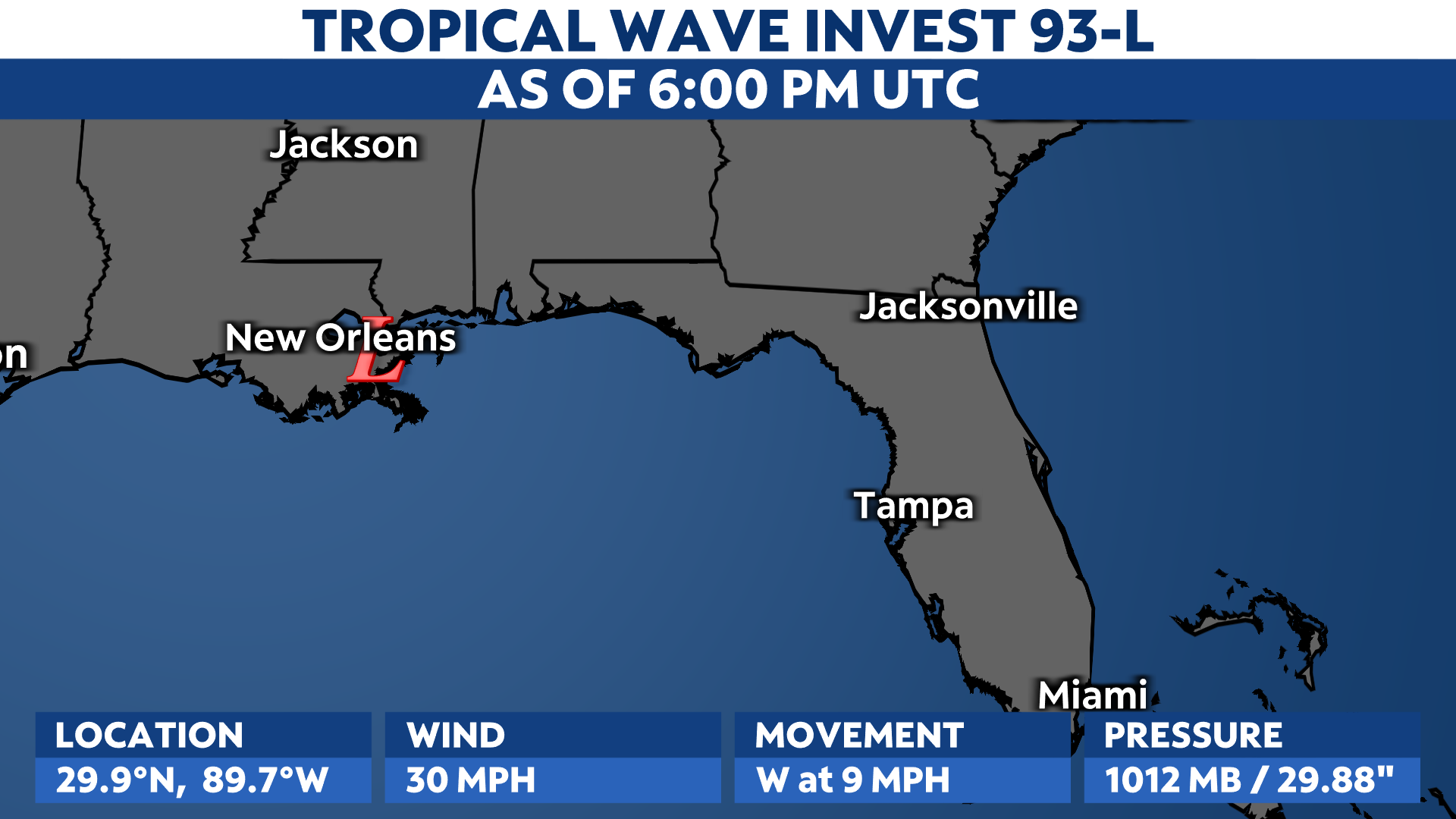
Tropical Storm Warnings remain in place and extend up through the Carolinas.

Storm surge
Storm surge, or the rise in water on top of expected tides, has been an even bigger issue than it would be–even for a storm as strong as this. The full moon is causing tides to run high, so the increase in water from the hurricane has been even larger.
The worst surge issues have been on Florida’s Gulf Coast, especially in the Big Bend region. Potential peak surge was forecast to reach up to 12 to 16 feet above ground level. This is comparable to what happened during Hurricane Ian in the Fort Myers area.
Here is a timelapse from Steinhatchee, Fla. as Idalia made landfall on the morning of Aug. 30, 2023.
Peak surge could reach up to a few feet along the coast of the Carolinas.
Storm surge has inundated parts of the Tampa Bay area. Water was at least a few feet deep in surge-prone parts of Pinellas County Tuesday, closing numerous roadways.
Rainfall
Heavy rainfall and flash flooding will be possible across the Southeast as Idalia moves inland. The highest rainfall totals are forecast to stretch from the Florida Panhandle and western coast through the Carolinas. Totals in some areas ought to exceed 6 inches.
As a result, Flood Watches are in place.
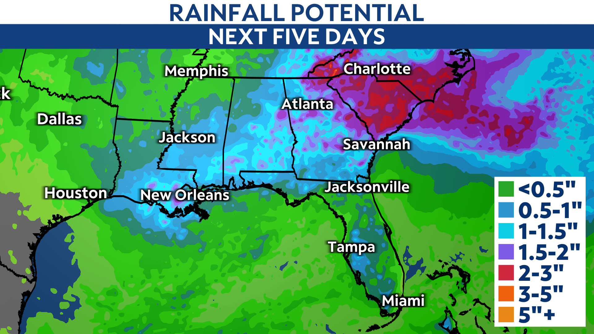
Along with the possibility of flash flooding, Idalia could also spin up tornadoes as the storm tracks over the Southeast.
Check here for a look at the 2023 Atlantic hurricane season so far.
Our team of meteorologists dives deep into the science of weather and breaks down timely weather data and information. To view more weather and climate stories, check out our weather blogs section.

