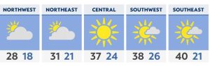
With increasing temperatures and no real storm systems approaching Ohio, much of the Buckeye State will see a relatively quiet week ahead.
What You Need To Know
- Overall, a quieter week of weather is expected
- We can’t rule out a stray lake-effect sprinkle or flurry
- Highs will warm into the 50s and even 60s late in the week
- The next chance of statewide rain will be Friday
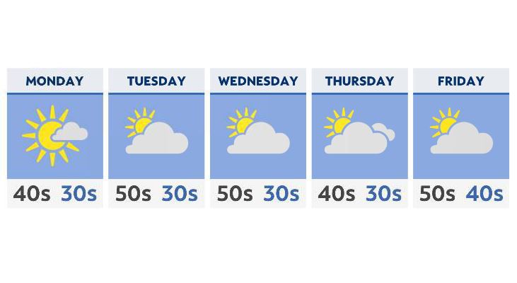
Monday will bring mostly sunny to partly cloudy skies across the state, with highs in the 40s and low 50s. While a few weak shortwaves (pieces of atmospheric energy) may pass through early on, we’ll see nothing more than a few clouds for most areas through Tuesday evening.
As some winds shift out of the north, we cannot rule out a lake-effect shower or flurry early in the week across the snowbelt, with most areas there seeing little, if any accumulation.
Ahead of a slightly more dynamic system, winds on Wednesday will gust out of the south and southwest, pushing many areas well into the 50s, with increasing clouds.
Thursday gives us a bit of a cool-down, and a few rain/snow showers across the lakeshore.
By Friday into the weekend, we’ll see a warm up again, with many of us in the 50s to near 60. The chance of rain returns statewide as we head into late Friday night and begin next weekend.