After a few very nice and mostly sunny days, the week ahead is looking a bit more unsettled, with shower and thunderstorm chances nearly each and every day.
What You Need To Know
- Unsettled weather returns for this upcoming week
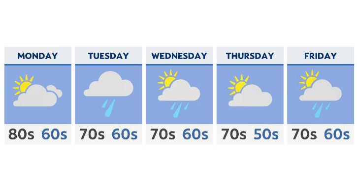
- Highs will be in the 80s Monday with late-day rain and storms
- Shower and storm chances remain for most of the week
- Highs mid-late week will mainly be in the 70s
After a more humid end to the weekend, Monday starts off with a few scattered showers, followed by more widespread rain by the afternoon and evening commute. A few thunderstorms are possible as well.
This will be along a pretty powerful front, with winds from the S and SW that will increase ahead of it’s passage Monday evening. With that, expect temperatures to climb well into the 80s on Monday before the rain starts to increase late in the day.
While severe weather is certainly possible, especially this time of year, a large outbreak is not likely. We’ll of course be watching.
In the meantime, showers move out Tuesday afternoon, with a bit of a break early Wednesday.
By the end of Wednesday evening, yet another front moves closer to Ohio, once again giving us a chance of showers and a few thunderstorms that will last into the late part of the week.
As far as temperatures go, while we’ll certainly cool down, expect highs to remain just slightly below average, in the mid 70s for most areas through the end of the week and even into next weekend.