After cold and snow Saturday and Sunday, the week ahead offers a welcomed return to springtime temperatures, along with a chance of rain (rather than snow!)
What You Need To Know
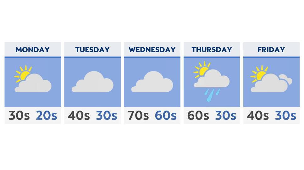
- Sunshine will return early in the week ahead
- Highs will approach the 60s and 70s by Wednesday
- Rain and a few storms possible late Wednesday into Thursday
- A big cool-down is in store for Friday; highs in the 40s
Monday will offer us a very cold start to the week, with no doubt the coldest temperatures we’ve seen for weeks. Everyone starts the day below freezing, with many areas in the teens and 20s. Mostly sunny to partly cloudy skies should help to thaw things out by the afternoon.
A weak front Tuesday could bring us a few sprinkles or even a scattered shower. Highs will slowly climb, but with NE winds and that overcast sky, it’ll be difficult to get much above the 40s.
That front lifts north on Wednesday, with soaring temperatures throughout the day. Highs will be in the 60s across the lakeshore, and well into the 70s in central and southern Ohio.
This will be followed by the attached cold front, which will significantly push our temperatures down by the end of the week. Expect highs in the 50s and 60s Thursday; 40s by Friday.
Rain and even a few storms will be possible by the mid to end of the week ahead.