While much of the week ahead won’t be unsettled in terms of snow or ice, we’ll see a chance to once again reinforce the bitterly cold temperatures across the state.
What You Need To Know
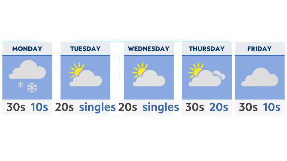
- A quick-moving system provides light snow for Monday
- Another very cold airmass moves in Tuesday and Wednesday
- Many areas will see lows in the single digits Wednesday into Thursday
- Unsettled weather returns by late Friday into next weekend
Monday starts us off with increasing clouds, as another quick-moving low pressure system moves in northwest to southeast. This will give us daytime and evening chances of accumulating snow across much of Ohio.
For most areas along I-70, expect an additional 1-2 inches on top of what we already received late in the weekend. Areas to the south, including Cincinnati, may see an additional dusting to half-inch, while the lakeshore and snowbelt areas will see higher amounts with some lake-effect snow continuing through Monday night.
The rest of the week ahead looks cold, although we’ll have a chance to temporarily thaw-out late Monday, with some near/at freezing temperatures.
Beyond that, the middle of the week offers another cold front pushing through Ohio, although this one is dry in nature, and other than a few flurries, won’t produce much in the way of precipitation.
The cold air though? That’s the bigger story.
Temperatures by Wednesday into Thursday will once again drop into the single digits, with wind chills well below zero in many areas.
We stay cold and dry through the end of the week, with a chance for unsettled weather returning by next weekend.