OHIO — After a stunning weekend, with highs in the 60s and 70s, and lows in the 40s and 50s, more heat and humidity is poised to build into the Buckeye State, with oppressively hot feels like temperatures by Tuesday into Wednesday.
What You Need To Know
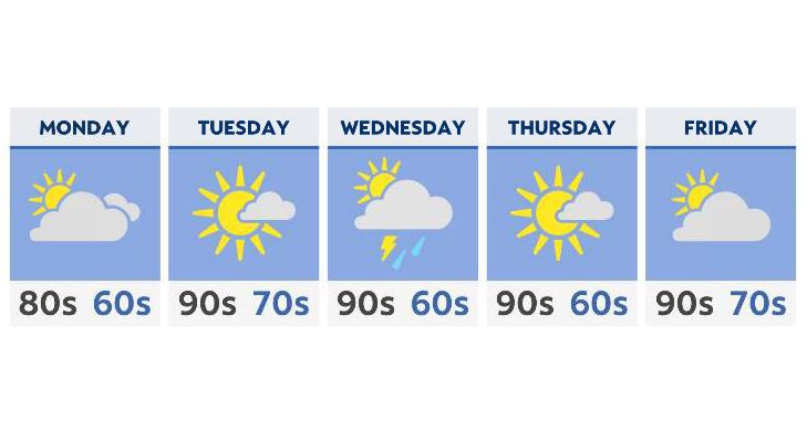
- Temperatures return to the 80s on Monday
- Highs by Tuesday and Wednesday may reach the mid to upper 90s
- Feels like temperatures will be well into the 100s
- A few showers and storms are possible by the middle of the week
Monday is the transition day, with some increasing clouds, increasing humidity levels and even a chance of a few showers (mainly N and E). This is along a ridge that will build and allow warm and humid air to flow into the state from the south.
Tuesday is when things really start to heat up. Highs will reach the 90s across many areas, especially central and NW Ohio. When you factor in the dewpoint, many of us may feel between 100 and 110 degrees.
We may see heat advisories and perhaps excessive heat watches or warnings.
Wednesday a front will move through, allowing a few shower and storms to develop. While we may not see a huge severe outbreak like we did last week, we’ll be watching for at least a few strong storms, given some instability in the atmosphere.
By the end of the week, sunshine returns, but the hot temperatures remain. In fact, we’ll most likely stay well into the 90s through at least the beginning of next weekend.