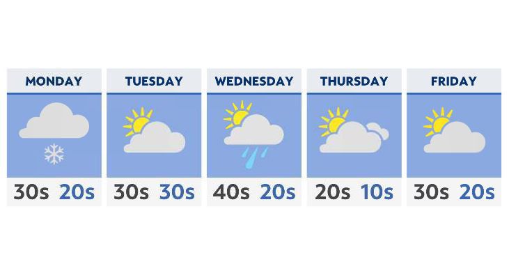
After the weekend snow, most of the week ahead will be quiet, with the exception of a cold front on Wednesday, which will give much of the state a chance of a wintry mix and snow.
What You Need To Know
- Some light snow showers possible for the east on Monday
- Our next cold front arrives by Wednesday with a chance of snow
- Another Arctic blast of below-average temperatures starting Thursday
- Despite the cold, some sunshine returns for Friday
Some accumulating snow will still be possible Monday, especially in extreme eastern Ohio, even as the main storm system exits well to our east. An additional inch or so is possible in those areas as we start the new workweek.
While most areas will see at least some clearing on Tuesday, lake effect snow showers and flurries will still be likely across the lakeshore. Gusty winds and a snow-covered ground will keep central and eastern sections of the state very cold, with highs barely above the freezing mark in many spots.
Further west, where less weekend snow was seen, will see more seasonable temepratures.
A cold front moves through for Wednesday, giving the state another chance of wintry precipitation. While some accumulation is likely, we’re unlikely to see significant snow amounts.
Beyond that, the end of the week is looking drier, but very cold. In fact, yet another Arctic blast behind Wednesday’s cold front will leave much of the state in a deep freeze, with high temperatures averaging about 10 degrees below average for this time of year.
Expect a better chance at more sunshine in the forecast (despite the cold temperatures) by Friday.