Another accumulating snow event is on the way for Wednesday.
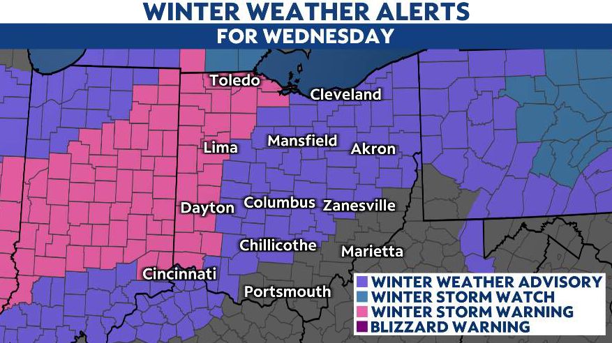
Widespread winter weather alerts will begin after midnight and will continue through Wednesday. A Winter Storm Warning has been issued across western Ohio, where the heaviest snow and highest accumulations are expected.

This storm will move in from the southwest before daybreak on Wednesday.
Very heavy snowfall is possible, mainly for the western third of the state.
Snow changes over to periods of cold rain/sleet for areas along I-71 and SE.

We are back to snow showers as temperatures fall again by Wednesday evening, with scattered snow showers lasting into Thursday.

Parts of northwest and west-central Ohio could get up to 8 inches of snow between Wednesday morning and Thursday morning.
Winds will also be breezy, so blowing and drifting snow will add to our travel woes.
Besides snowfall, there could be some light icing from sleet, making any untreated roads slippery.

Scattered snow showers wrapping in on the backend of this system will continue Wednesday night into Thursday, so we can expect travel impacts to continue through at least early Thursday.
Our team of meteorologists dives deep into the science of weather and breaks down timely weather data and information. To view more weather and climate stories, check out our weather blogs section.