Cindy formed late in the central Atlantic on June 22, becoming our third named storm of the season.
Cindy maintained its status as a tropical storm for three days, but gradually weakened over the weekend as it combatted increasing wind shear.
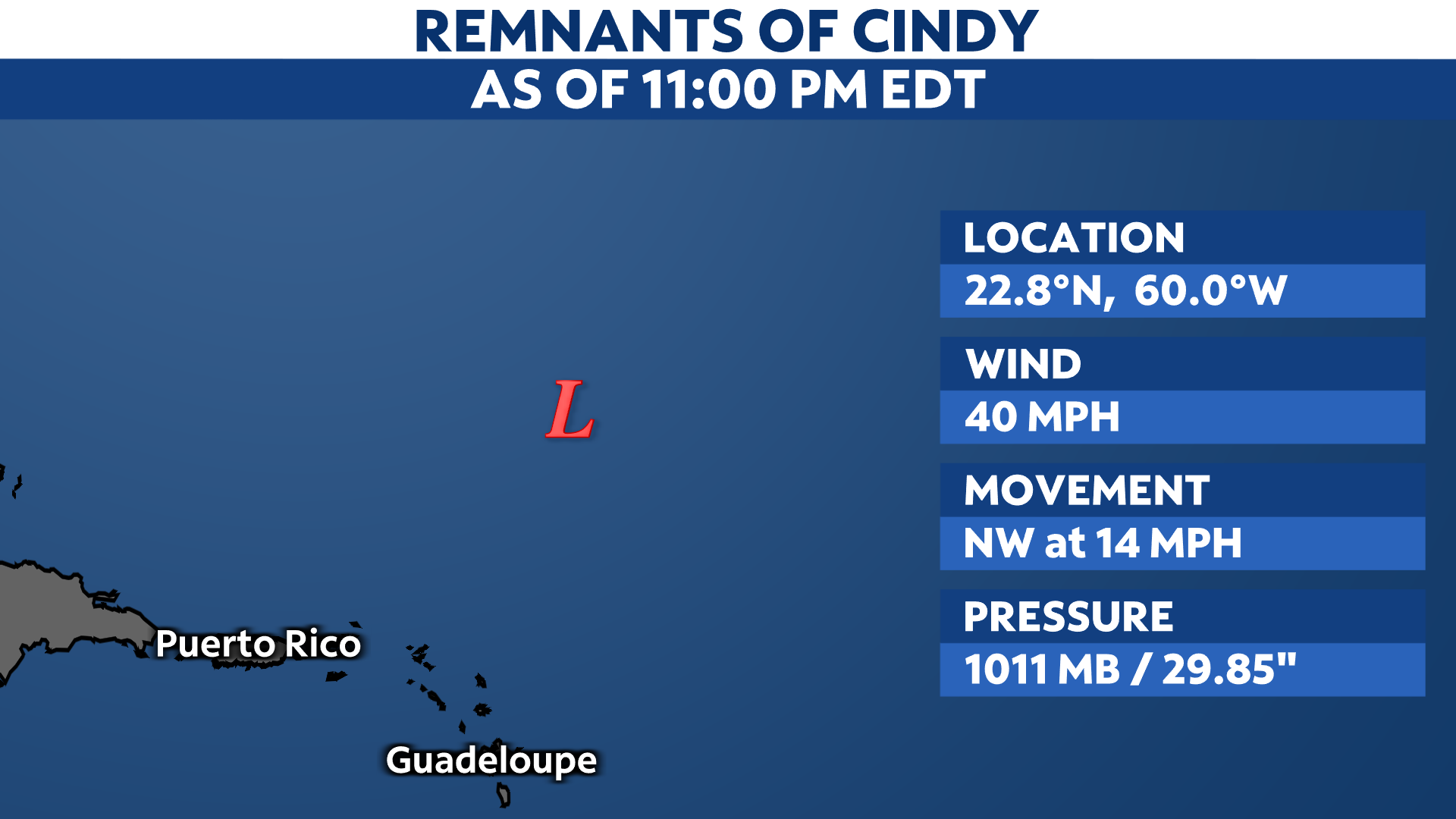
It finally became a remnant low Sunday night, with maximum sustained wind speeds of 40 mph.

The remains of Cindy continue to drift toward the northwest, staying well north and east of the Leeward Islands. While it could generate rough surf, it will stay far enough away from land areas for the time being.
For a look at the 2023 Atlantic season so far, click here.
Our team of meteorologists dives deep into the science of weather and breaks down timely weather data and information. To view more weather and climate stories, check out our weather blogs section.