OHIO — Get ready! Big changes are in the forecast across the state. A powerful October cold front will usher in the coldest air mass of the season to kick off the new work week. High temperatures will be 10 to 20 degrees below normal in most areas.
What You Need To Know
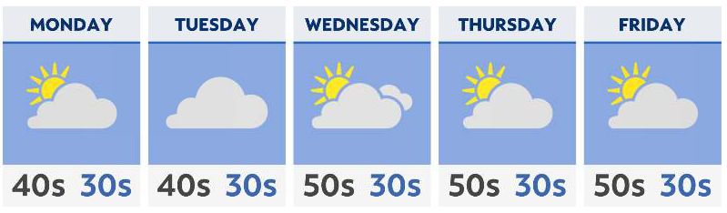
- Potent cold front will drop high temperatures to the 40s and 50s
- Overnight lows in the 30s will support frost
- Rain showers in northern Ohio may mix with wet snowflakes at night
- Temperatures will gradually rebound by the weekend
Gusty westerly winds will usher in high temperatures that haven’t been witnessed here in Ohio since last April. For many, the mercury will only rise into the middle and upper 40s on Monday, Tuesday, and Wednesday. The coolest temperatures will be observed across northern Ohio. Parts of southern Ohio may still reach 50 degrees.
While the front will pass by with little-to-no moisture, showery weather is expected to develop in its wake downwind of the Great Lakes. That means residents of northern Ohio will have the chance for some precipitation. Even though a stray shower is possible in central and southern Ohio, the lack of any appreciable rainfall will continue to persist there.
Lake-enhanced moisture will bring scattered showers to Northeast Ohio, and to a lesser extent Northwest Ohio, through midweek. Cold temperatures at the surface and aloft may support a few wet snowflakes mixing with the rain during the nighttime and early morning hours of Monday and Tuesday.
Eventually, a shift in the overall weather pattern will begin to dry things out and allow more sunshine by Thursday and the end of the week.
Temperatures are forecast to return to the middle and upper 50s for highs on Thursday with 60s possible in the southern half of the state on Friday. Dry weather will be found throughout Ohio to wrap up the week.