After a quick warmup and day to prepare Tuesday, a major winter storm looks to take direct aim at our region beginning Wednesday morning.
This winter storm is expected to be a prolonged event, lasting over two days and bringing a variety of precipitation types to Ohio.

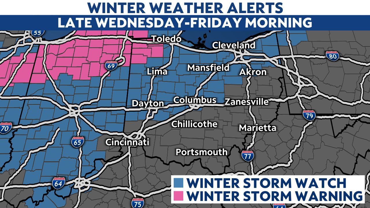
There are still many questions about the track this storm will take, which will ultimately determine precipitation types and amounts. However, it is likely this storm will have a significant impact on Ohio and will likely create dangerous travel conditions as early as Wednesday evening across northwest Ohio.
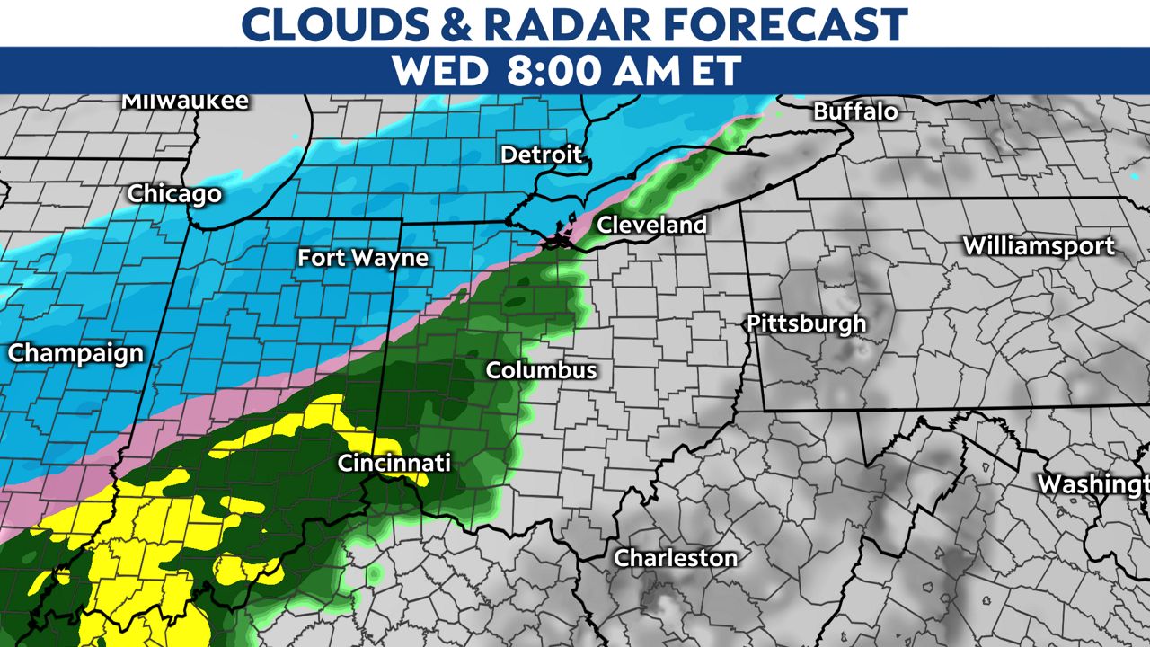
Colder air will slowly filter south and east through Wednesday, arriving in central Ohio around or shortly after sunset Wednesday evening. Conditions are then forecast to deteriorate more quickly as we head through Wednesday night as precipitation increases and temperatures fall.
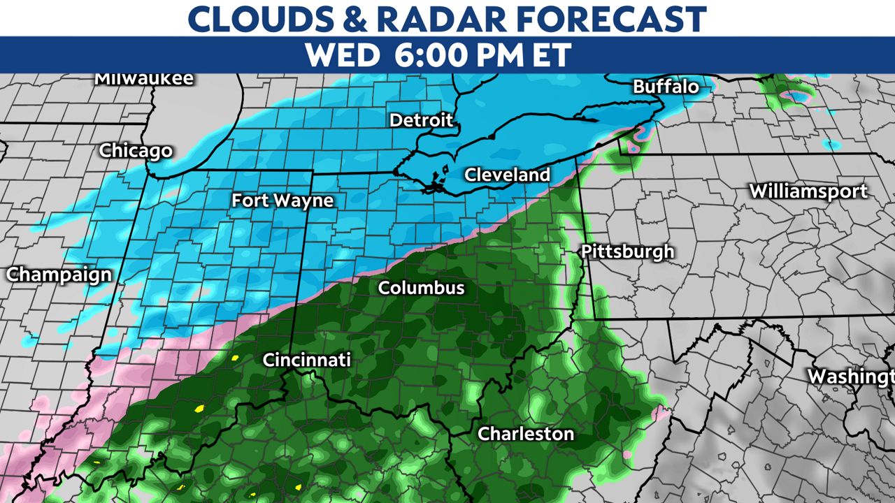
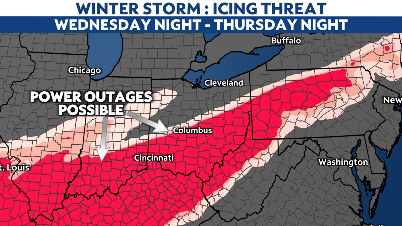
As cold air undercuts warm air aloft in central and southern Ohio, freezing rain and sleet will likely develop Wednesday night into Thursday morning.
Where icing develops, it could being quite dangerous, weighing down trees and power lines. It is very possible there will be numerous power outages where sigificant icing occurs. Right now, it looks like the greatest threat for icing will likely set up somewhere near the I-71 to I-70 corridors and to the south.
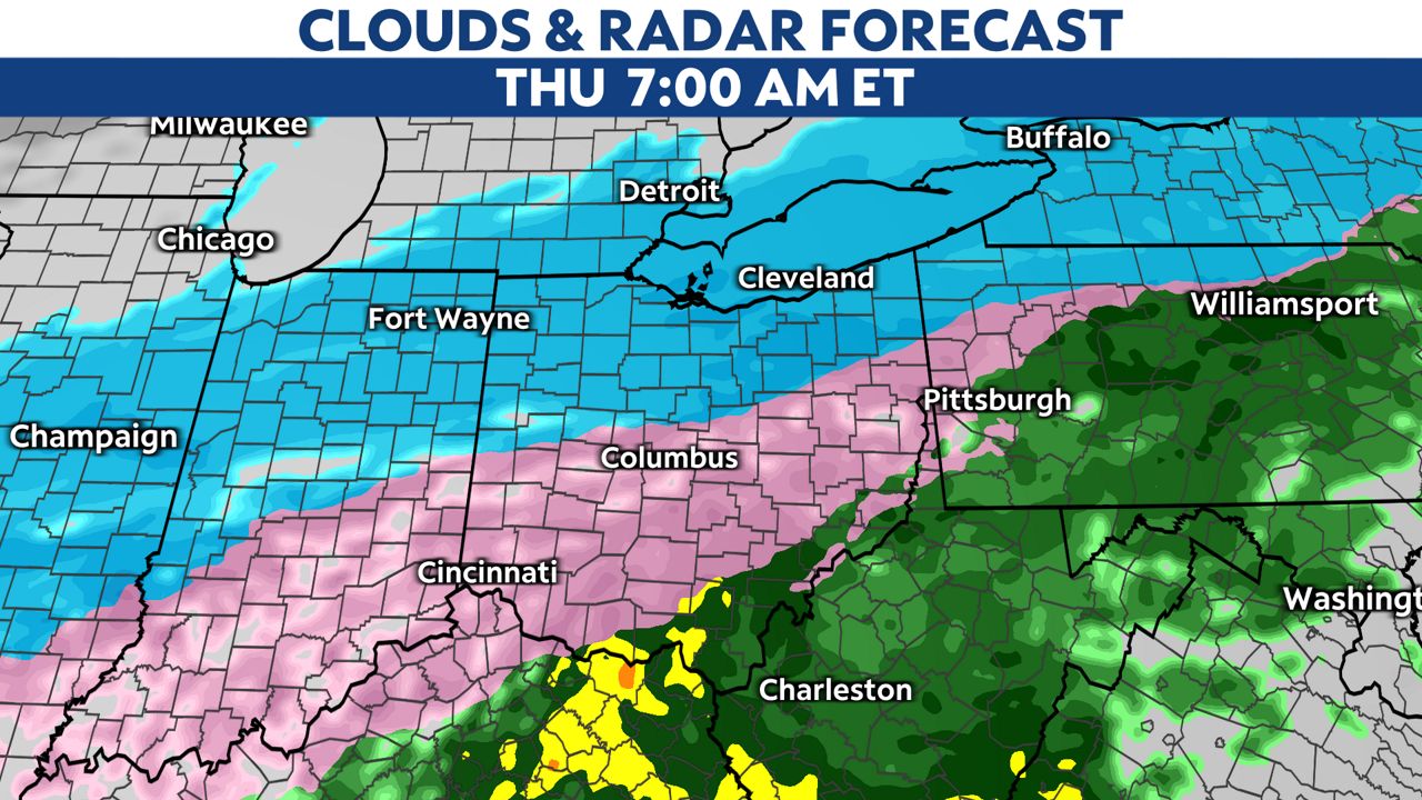
Farther south, mainly southeast of I-71, mostly rain is expected through Thursday morning, where over two inches will be possible. The heavy rain could lead to flash flooding. As temperatures rapidly drop Thursday night, a flash-freeze will be possible, changing any standing water to ice.
Precipitation will exit the region Friday morning in the form of snow. Snow accumulation will be light in southern Ohio as the precipitation will be moving out as it gets cold enough for snow.
This storm will bring significant amounts of snow, possibly over a foot in some locations in northern Ohio. Farther south, near and just north of the I-70 corridor, ice and sleet will be likely with several inches of snow falling on top of the ice Thursday night. The snow on top of ice could add weight to trees and power lines, creating the potential for additional power disruptions.
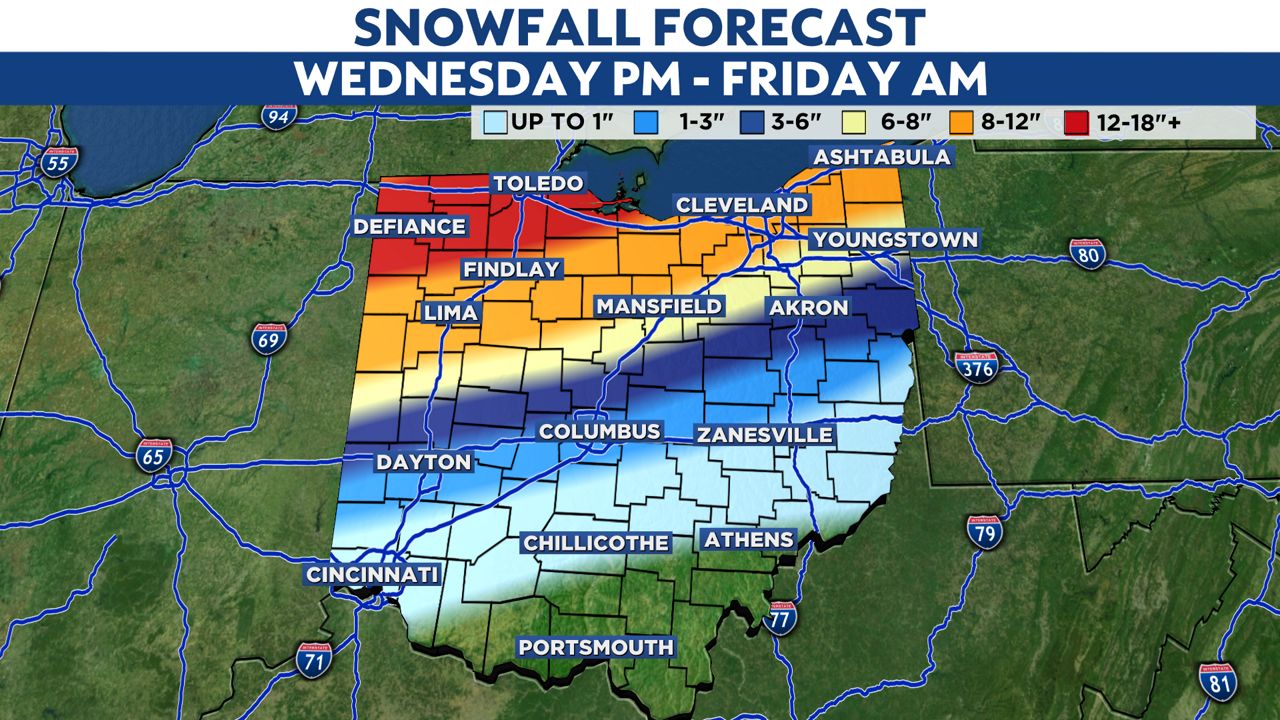
Where exactly the heaviest amounts will fall are still uncertain at this time. Everyone will want to pay close attention to later forecasts on this storm as new models and details come out.
Go here to sign up for weather-related notifications on your phone from the Spectrum News app.