After a brief lull in our wintry weather, including an early week warm-up, a major winter storm looks to take direct aim at our region beginning Wednesday.
This winter storm is expected to be a prolonged event, lasting over 2 days, and bringing a variety of precipitation types to Ohio.
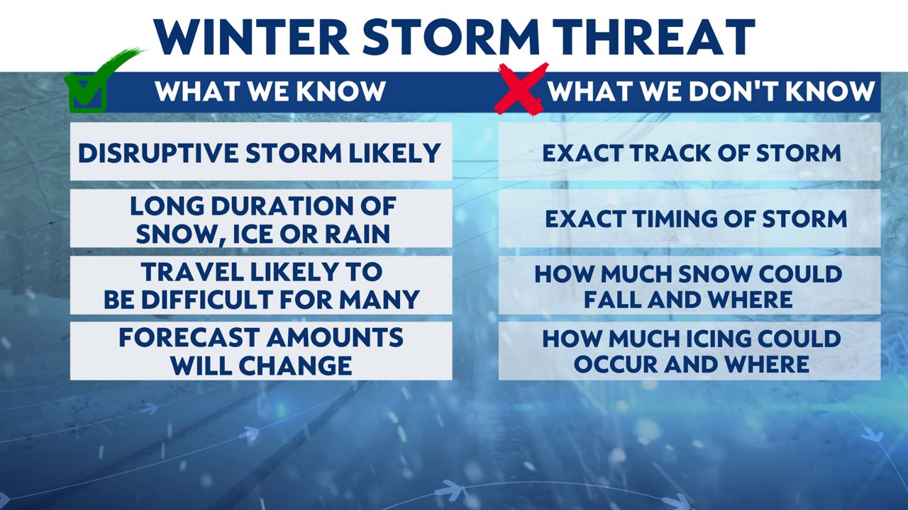
There are a lot of questions about the track this storm will take which will ultimately determine precipitation types and amounts. However, it is likely this storm will have a significant impact on Ohio and may create dangerous travel conditions as early as Wednesday evening across northwest Ohio.
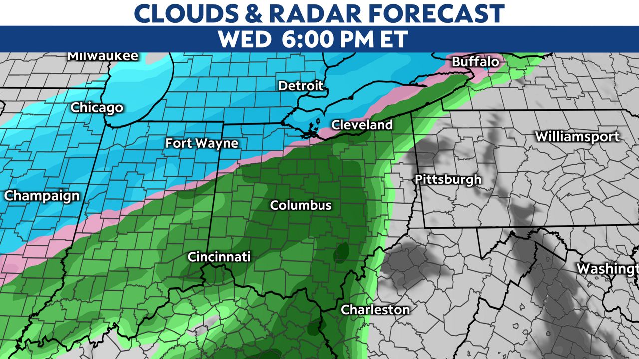
While mostly snow is currently expected across northwest Ohio beginning Wednesday, a band of heavy sleet and freezing rain is likely to set up in areas just to the south of where the heaviest snow falls. This wintry mix will slowly shift southeast through Wednesday night into Thursday.
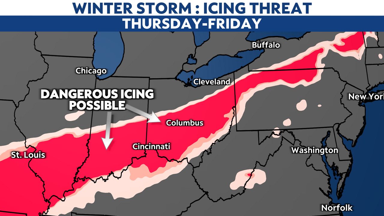
Where icing develops, it could being quite dangerous, weighing down trees and power lines. It is very possible there will be numerous power outages were sigificant icing occurs. Right now, it looks like the greatest threat for icing will likely set up somewhere near the I-71 to I-70 corridors.
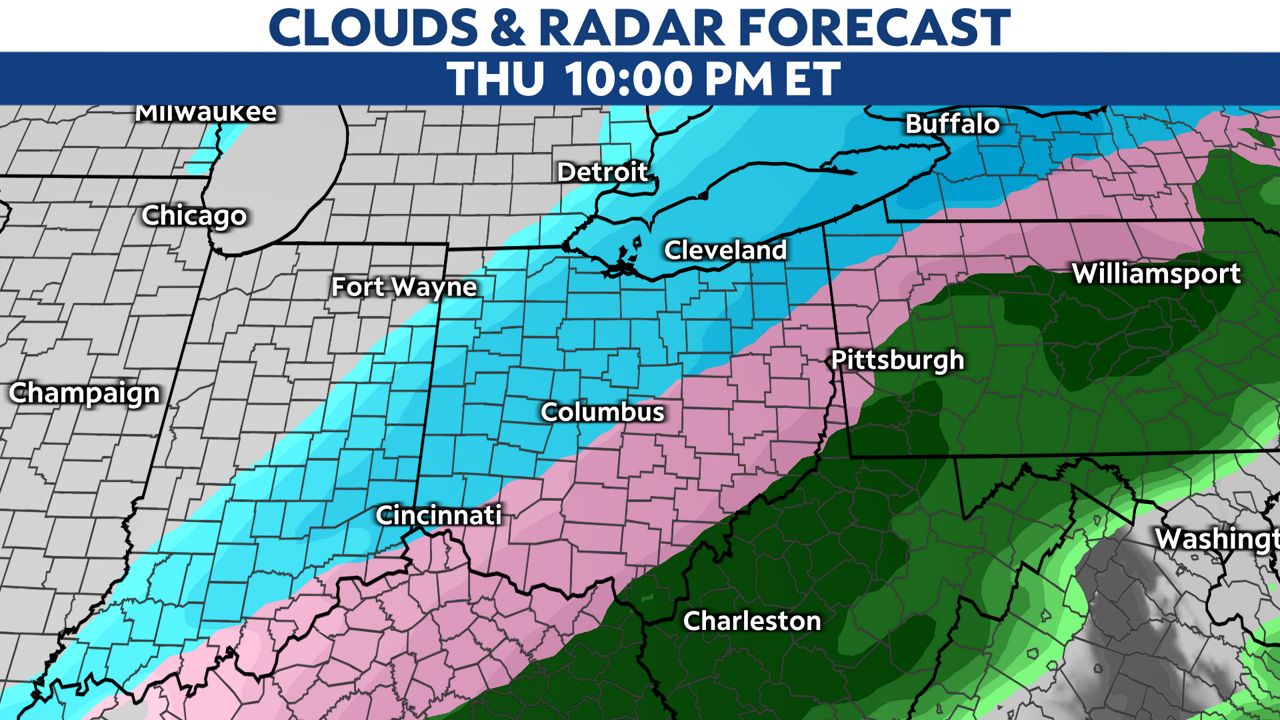
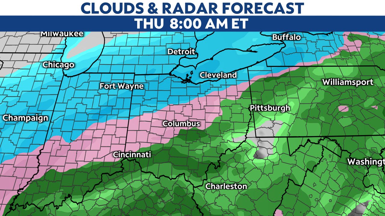
Farther south, mainly southeast of I-71, mostly rain is expected through Thursday morning, where over 2 inches will be possible. The heavy rain could lead to flash flooding. As temperatures rapidly drop Thursday night, a flash-freeze will be possible, changing any standing water to ice.
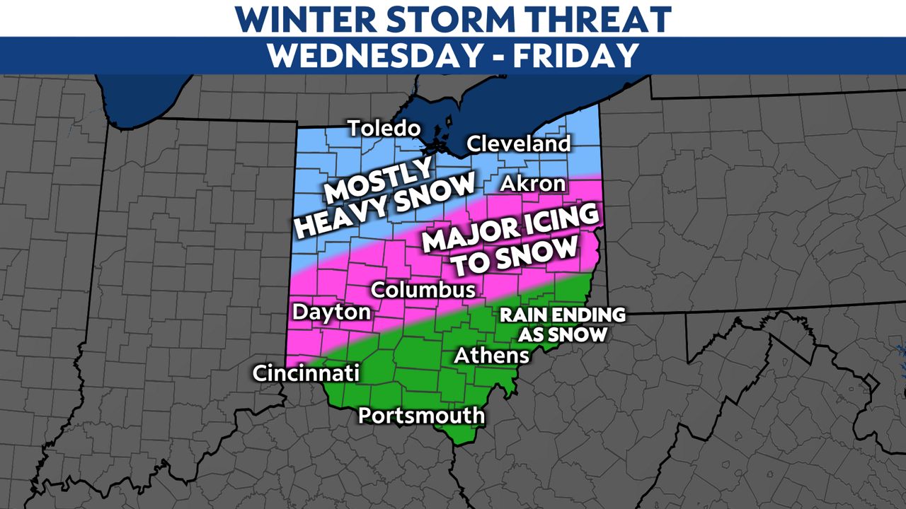
Preciptiation will exit the region late Thursday night through early Friday morning in the form of snow. Snow accumulation will be light in southern Ohio as the precipitation will be moving out as it gets cold enough for snow.
This storm will bring significant amounts of snow, possibly over a foot in some locations, along with dangerous icing south of the heaviest snowfall. Where exactly the heaviest amounts will fall are still unknown at this time.. Everyone will want to pay close attention to later forecasts on this storm as new models and details come out.