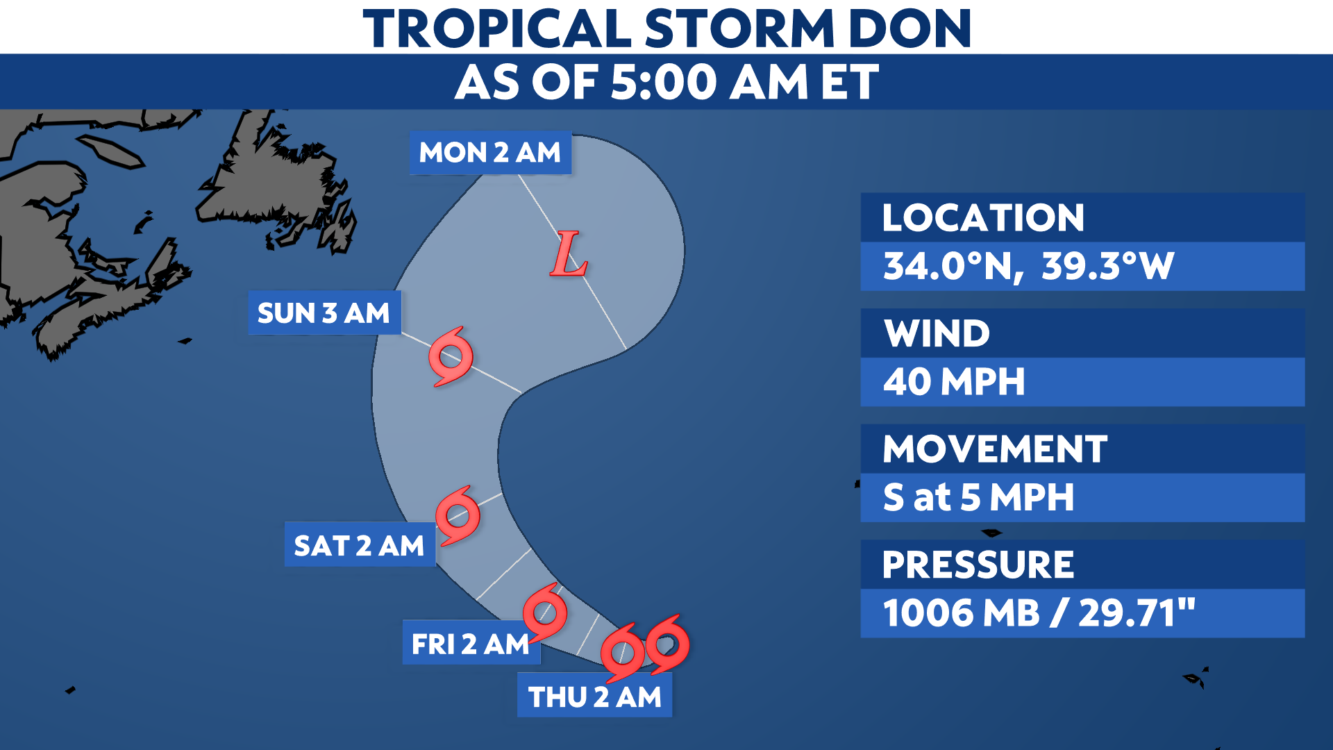
After spending its first days as a subtropical storm, Don became fully tropical on Monday afternoon. Despite slight changes in strength, it remains a weak tropical storm roaming the central Atlantic. It will continue to not impact any land areas this week.
Located less than 750 miles west-southwest of the Azores, Don remains a tropical storm, with maximum sustained winds of 40 mph.
It will continue to complete its clockwise loop over the central Atlantic Ocean this week, where it will soon start to turn toward the west Wednesday night into Thursday before it turns toward the north later this week into the weekend.
Don’s intensity is not expected to change much, but could undergo some additional strengthening over the next couple of days.
However, Don is expected to weaken thereafter once it moves over the colder waters of the northern Atlantic over the weekend.
Regardless, it is still forecast to remain a tropical storm for the time being, where it will not affect the U.S.
Don formed on Friday, July 14, becoming the fourth named storm of the 2023 Atlantic hurricane season.
Check here for a look at the 2023 Atlantic hurricane season so far.
Our team of meteorologists dives deep into the science of weather and breaks down timely weather data and information. To view more weather and climate stories, check out our weather blogs section.