November begins with some much-needed sunshine but also brings in the coldest shot of air we’ve seen all season.
What You Need To Know
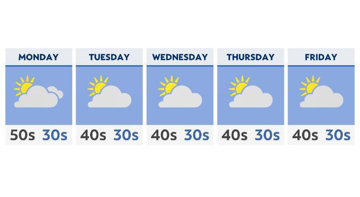
- A drier and sunnier pattern moves in as we start the new week and month
- Some of the coldest air of the season settles in by mid-week
- Highs will struggle to get out of the 40s
- Overnight lows will be near freezing by Wednesday and into the end of the week
After a rainy weekend and the end of October, high pressure moving in from the northwest will continue to clear things out and dry things up.
However, the upper-level wind pattern, known as the jetstream will create a troughing pattern that will separate colder, Canadian air from the milder more seasonable air just to the south of Ohio. This means an unseasonably cold start to the month.
With that said, as temperatures struggle during the day to get out of the mid-40s this week, it’s the overnight lows that will significantly impact us. Most locations across Ohio will not only have a very good chance of hitting the freezing mark by Wednesday morning, but some areas (especially SE Ohio) could hit the upper 20s.
Of course, this also means any precipitation that would potentially fall would be frozen. While a flurry or two cannot be ruled out in one or two spots by Thursday morning, our weather pattern will be mainly dry, as any fronts that reinforce the colder air are going to be moisture-starved.
Remember to take any sensitive plants in this week and make sure the outdoor pets are inside, as the temperatures drop!