The warm temperatures we have today and tomorrow could lead to some severe weather on Thursday.
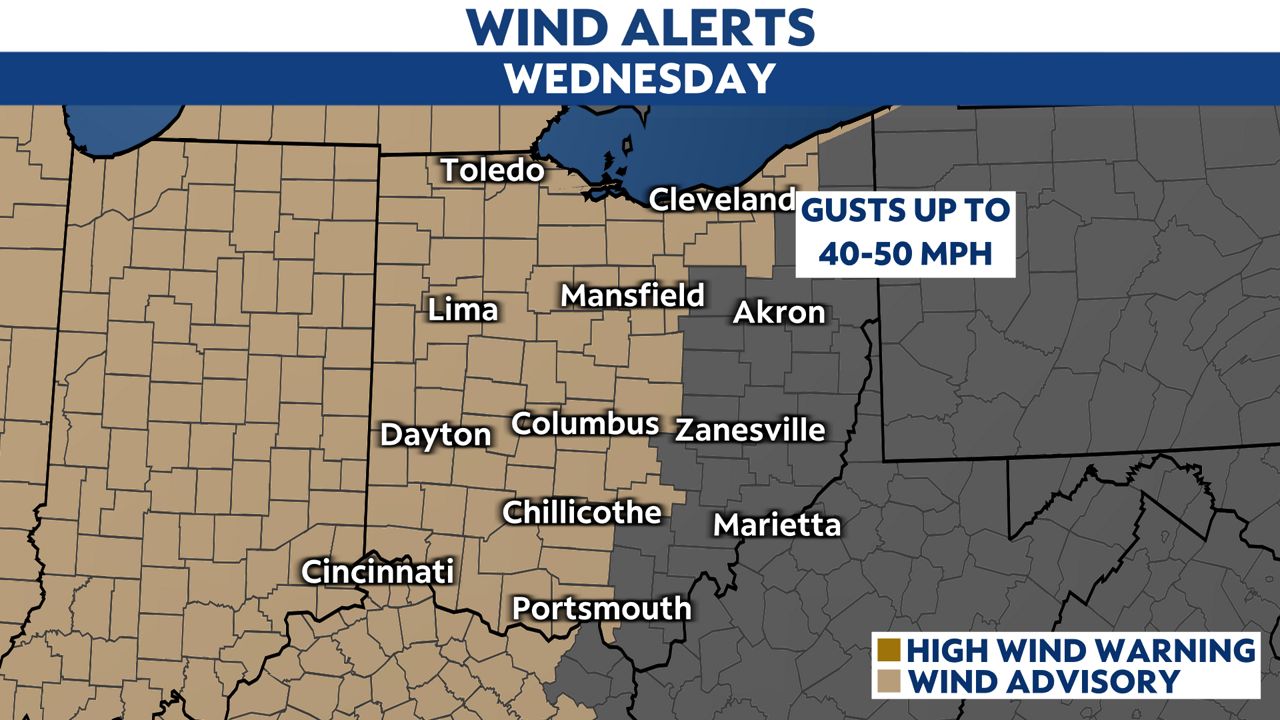
Wind advisories are up through Wednesday night but will likely extend into Thursday.
A 56 mph wind gust was recorded at Burke Lakefront Airport in Cleveland.
)
Wind and flooding will be concerns during the daytime on Thursday.
Heavy rainfall of 1-2 inches is possible on Thursday so most of the state is under a flood watch through Thursday evening.
-4)
Melting snow with heavy rain could cause issues in low-lying areas.
Along with flooding, some severe weather is possible as this very strong cold front moves in.
Some storms especially south of I-70 could have damaging winds and even isolated tornadoes.
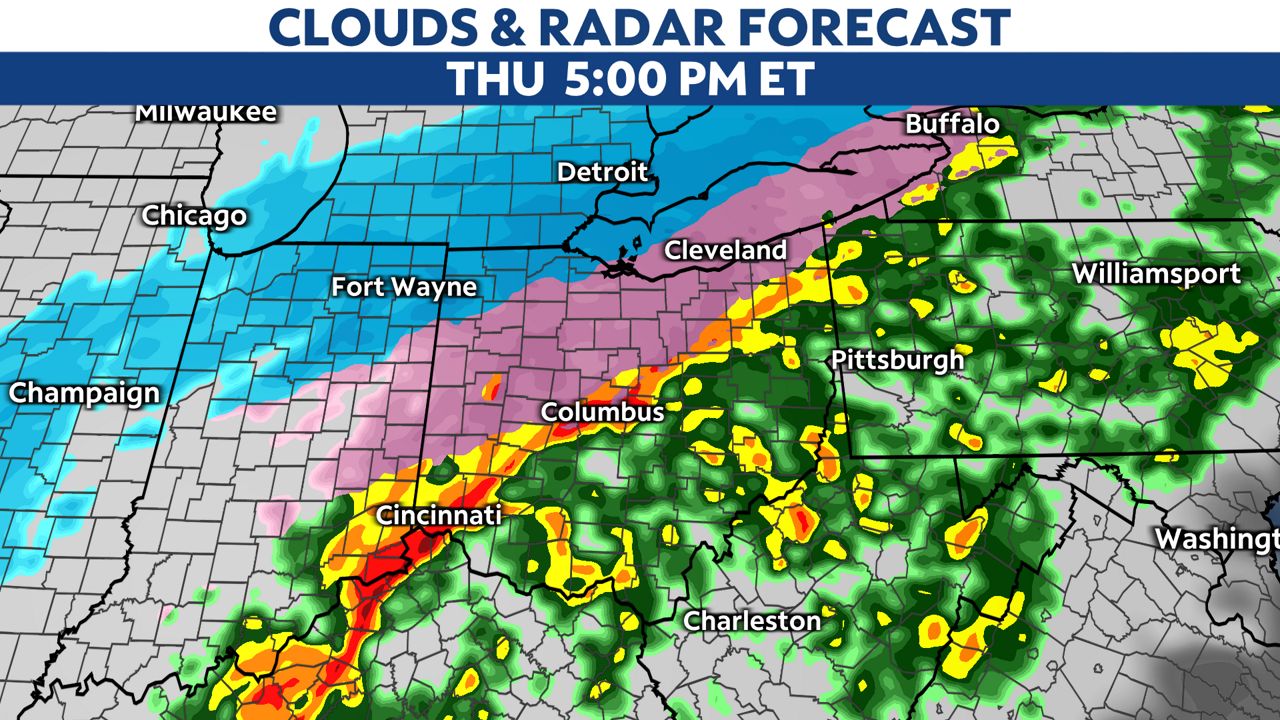
The highest risk for severe weather will be for parts of southern Ohio highlighted in yellow with a slight risk.
The most likely time frame for seeing severe weather will be 5pm through 11pm Thursday night.

After the severe weather potential winds down, we will see rapidly falling temperatures Thursday night into Friday morning.
This will lead to rain changing to wintry-mix and light snow.
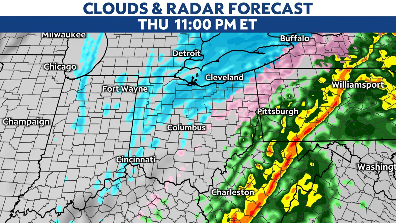
Any surface that is wet or untreated could freeze and become icy.
Snow could lead to snowy roads in northern Ohio late Thursday through early Friday so winter weather advisories may be issued there.