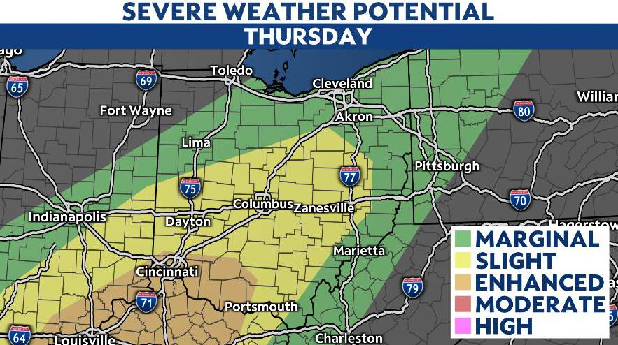
Nearly all of Ohio has the potential for strong to severe thunderstorms later Thursday.
With a spring setup midweek, a severe weather threat develops for Thursday, especially for western and central Ohio. Turn on weather notifications in the Spectrum News app here.

Plan ahead for the potential for impacts on travel throughout Thursday.

Details
By Thursday’s morning commute, widespread heavy, steady rain is expected to move in, with embedded thunderstorms possible.
The first wave of widespread activity pushes out by lunchtime and we’ll begin to see breaks. However, additional storms are expected to develop during the afternoon and evening as the cold front inches closer to the state.
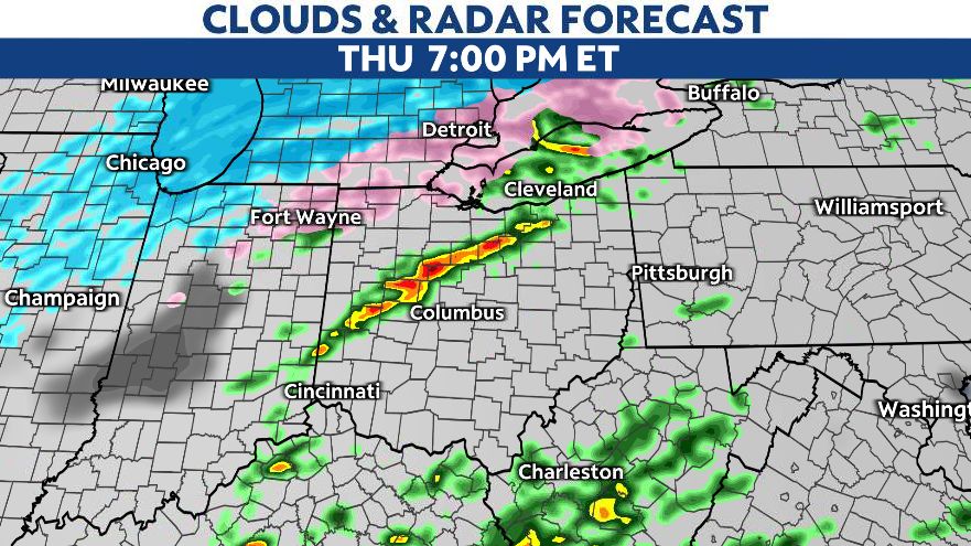
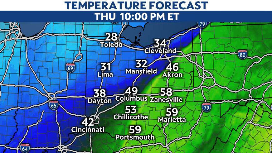
The cold front sweeps through the Ohio Valley Thursday evening, and behind the front, temperatures drop quickly!
As the cold air arrives, our severe weather threat diminishes Thursday evening.
Threats
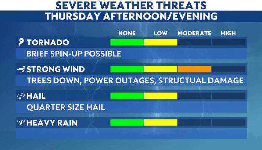
Our greatest threat will be gusty, damaging winds. Wind gusts could reach up to 65 mph.
However, we can’t rule out the potential for an isolated tornado, either. The greatest threat at this time appears as if it will be in southwestern Ohio.
Our team of meteorologists dives deep into the science of weather and breaks down timely weather data and information. To view more weather and climate stories, check out our weather blogs section.