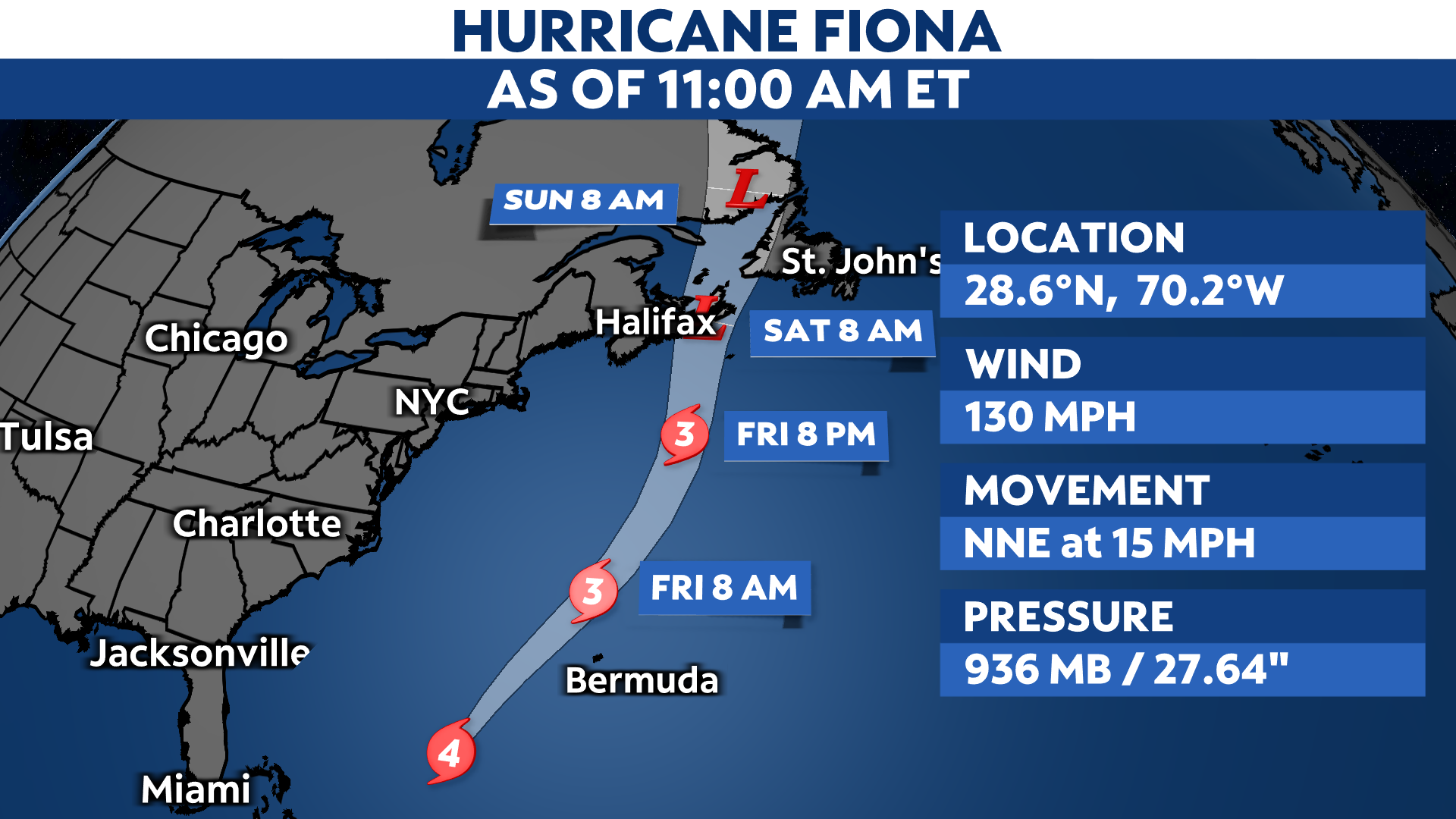
Hurricane Fiona is maintaining is strength as a Category 4 hurricane on Thursday. It will continue to track northward and pass Bermuda Thursday night, where a Hurricane Warning is in effect. Parts of Atlantic Canada are under Hurricane Watches and Tropical Storm Watches, as well.
From there, it’ll head toward the Canadian Maritimes, bringing damaging winds and heavy rainfall this weekend.
Fiona is heading northeast as a major hurricane. While Fiona’s center will pass west of Bermuda, it’ll still come close enough to produce hurricane conditions on the island tonight into Friday morning.
The hurricane has top estimated winds of 130 mph. It’s likely peaked in intensity but will maintain its strength through tonight, and will remain powerful right into the weekend even as it becomes post-tropical.

Atlantic Canada will face strong wind gusts, storm surge and heavy rain Friday night into Saturday. Rainfall amounts could top five inches in some areas. Impacts there begin later Friday.

While the U.S. doesn’t have any direct impacts from Fiona, swells from the hurricane will generate areas of rough surf and dangerous rip currents.
Forecast models agree Fiona will bend northeast before returning to a northerly heading into eastern Canada.

Spaghetti models or plots show a series of individual computer forecast models together on one map. They are useful to give insight into whether multiple models are in agreement on the path of the storm but they do not address the storm’s forecast intensity, winds, flooding and storm surge potential or other data. Tap here for more details on how to best use these models.
Fiona’s history
Fiona became the third hurricane of season in the Atlantic, and it was the first to make landfall–not once, but twice. Even though it battered Turks and Caicos on Tuesday, the center of Fiona stayed just east of the islands.
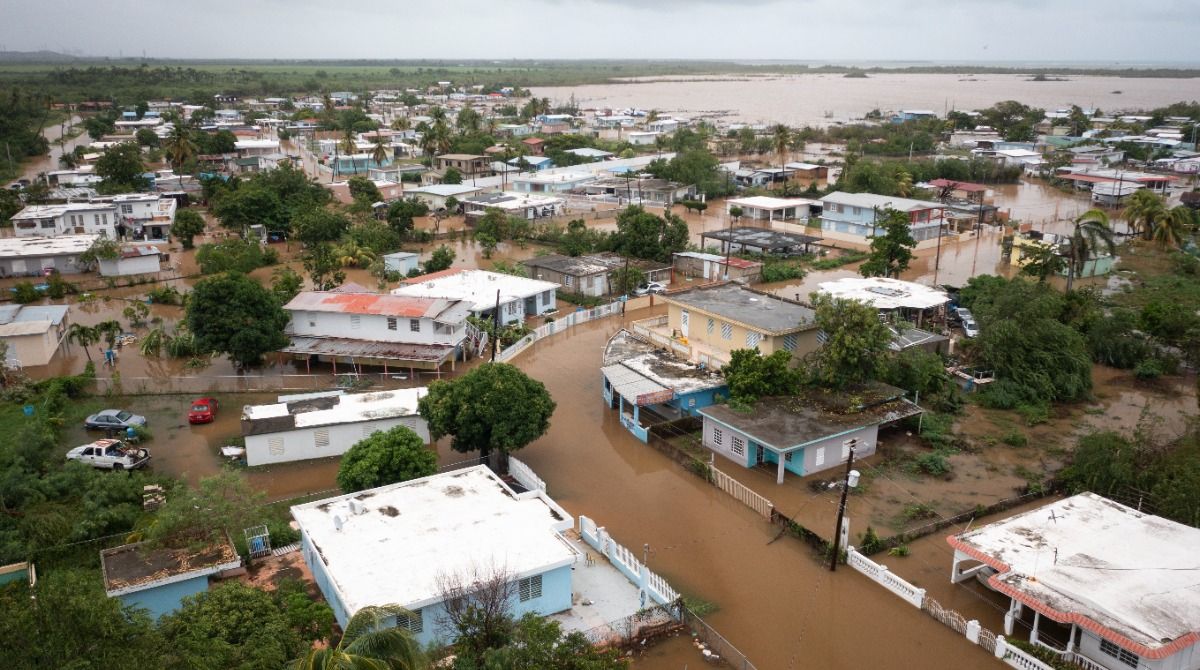
Heavy rains from Fiona caused mudslides and catastrophic flooding in Puerto Rico. Parts of the island got between 15 and 20 inches of rain with locally higher amounts.

A road blocked is blocked by a mudslide caused by Hurricane Fiona in Cayey, Puerto Rico, Sunday, Sept. 18, 2022. (AP Photo/Stephanie Rojas)
The Associated Press reports Thursday that well over half of Puerto Rico’s electric customers are still without power, and nearly a half-million are without water. This is happening amidst heat indices over 100 degrees in coastal areas.
U.S. Senate Majority Leader Chuck Schumer said he’ll push for the federal government to cover all of the disaster response costs, rather than the standard 75%.
Playa Salinas in Puerto Rico became flooded from Hurricane Fiona’s torrential rains on Monday, Sept. 19, 2022. (AP Photo/Alejandro Granadillo)
Fiona made landfall a second time near Boca de Yuma in the Dominican Republic, where it brought powerful winds and heavy rainfall across eastern Hispaniola. Eastern parts of the island faced flash flooding and wind damage from the storm.
Fiona became a major hurricane on Tuesday once it moved off the northern coast of the Dominican Republic and over the warm waters of the Atlantic.
It continued to head north, where it battered the Turks and Caicos Islands and parts of the southeastern Bahamas with hurricane and tropical storm conditions, despite not making landfall there.
Along with Fiona, we continue to monitor Tropical Storm Gaston in the central Atlantic, as well as a few other areas that have the potential for development. You can see the latest here.
See how the 2022 Atlantic hurricane season has gone so far.