Hurricane Ian made landfall in southwest Florida on Wednesday afternoon. Its first landfall was just after 3 p.m. on Wednesday in Cayo Costa, Fla. with max winds of 150 mph. After that, it made a second landfall, as it moved inland just south of Punta Gorda near Pirate Harbor with max winds of 145 mph.
Even though Ian has been weakening since moving inland, it will continue to produce damaging winds along with life-threatening flooding and heavy rainfall.
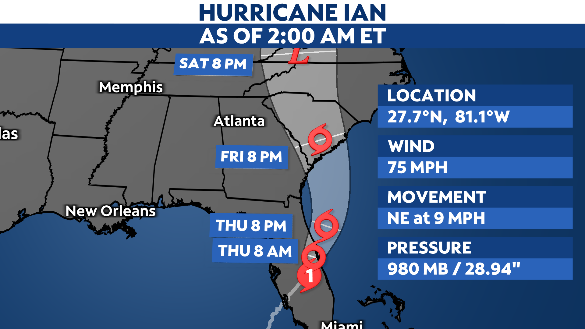
Now that Ian is moving over land it will weaken as it moves north-northeast. Its current max winds are 75 mph, a Category 1. It will move over the Atlantic before it brings rain to Georgia, South Carolina and North Carolina.
Ian is the first hurricane to make landfall in the continental U.S. this year. It will continue to move inland and north-northeast across the Florida peninsula, weakening into a tropical storm by Thursday.
A weather station near Port Charlotte reported a sustained wind of 115 mph with a wind gust of 132 mph as Ian made landfall Wednesday afternoon. Other parts of southwest Florida have reported dangerous storm surge, up to 12 to 18 feet inundation in spots.
Along with catastrophic winds and storm surge, Ian will bring heavy rainfall, which could lead to significant flooding and rainfall totals up to 15 to 20 inches with locally higher amounts.

Hurricane and tropical storm conditions will continue to spread inland across the rest of the peninsula through Thursday.
Hurricane Warnings remain in effect for a good portion of the Florida Gulf Coast, extending inland to parts of Central Florida toward Florida’s Atlantic Coast. Tropical Storm Warnings are in effect across the Florida panhandle and along the coasts of Georgia into the Carolinas.
Parts of the Bahamas are also under a Tropical Storm Warning.

In addition to the strong winds, storm surge will also be a concern for parts of northeastern Florida coast on the Atlantic up to South Carolina, as Ian has the chance to strengthen again offshore in the Atlantic before it moves inland again near South Carolina.
Parts of southwest Florida, including Naples, have been inundated with high water through Wednesday as Ian came ashore.
Potential storm surge could reach as high as 12 to 16 feet above ground level from Englewood to Bonita Beach, Fla. North of Ian’s center, surge levels will be lower.
A Storm Surge Warning remains in effect along most of Florida’s west coast, as well as Florida’s Atlantic coast for the Flagler/Volusia County line to the mouth of the St. Mary’s River, and the St. Johns River.
A Storm Surge Watch is in effect for the Florida Bay and the mouth of St. Mary’s River to South Santee River.

Along with all the other impacts, strong thunderstorms embedded in Ian’s outer bands could spin up tornadoes. The threat will spread up the peninsula as the hurricane moves north on Wednesday.
Extremely heavy rain will lead to flooding. Some areas could receive more than a foot of rain. In those areas, damage from the flooding may be severe. River flooding will be major, possibly breaking records in some locations.

Ian is on track to make landfall in southwest Florida. It has continued to shift south and east since the weekend, pushing the location for landfall farther south of Tampa Bay.
Even though the southern track is better news for Tampa and the west-central Florida coast in regards to top winds and storm surge, impacts can and do occur outside the forecast cone.
Ian’s center may move back over water before curving back toward the Carolinas.
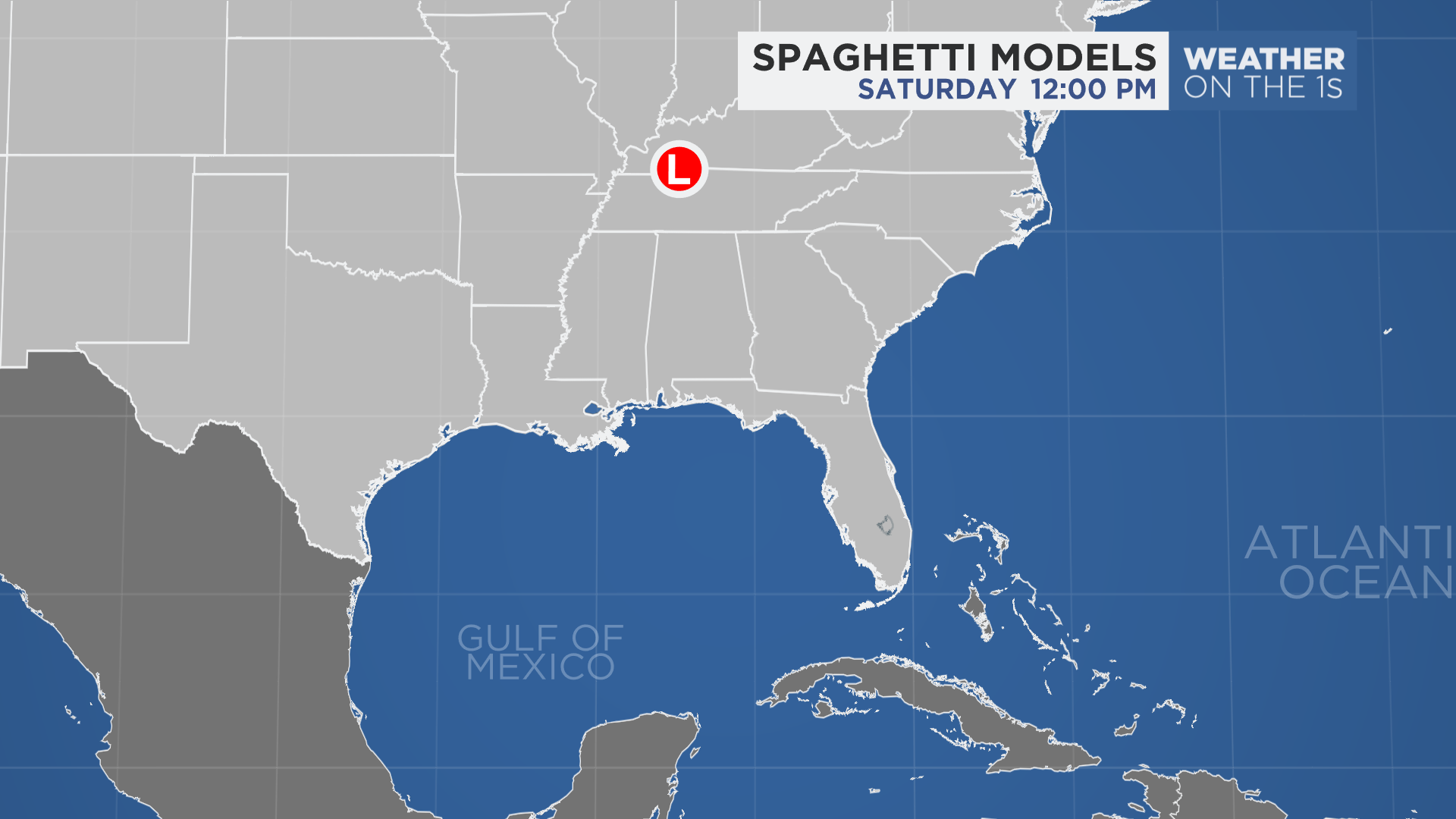
Spaghetti models or plots show a series of individual computer forecast models together on one map. They are useful to give insight into whether multiple models are in agreement on the path of the storm but they do not address the storm’s forecast intensity, winds, flooding and storm surge potential or other data. Tap here for more details on how to best use these models.
Ian’s history
Ian became the ninth named storm of the 2022 Atlantic hurricane season on the evening of Sept. 23. Even though it was slow to strengthen, Ian underwent rapid intensification once it become a hurricane on Monday.
Ian made landfall as a major hurricane just southwest of La Coloma, a town in the Pinar del Rio Province of Cuba around 4:30 a.m. on Tuesday morning.
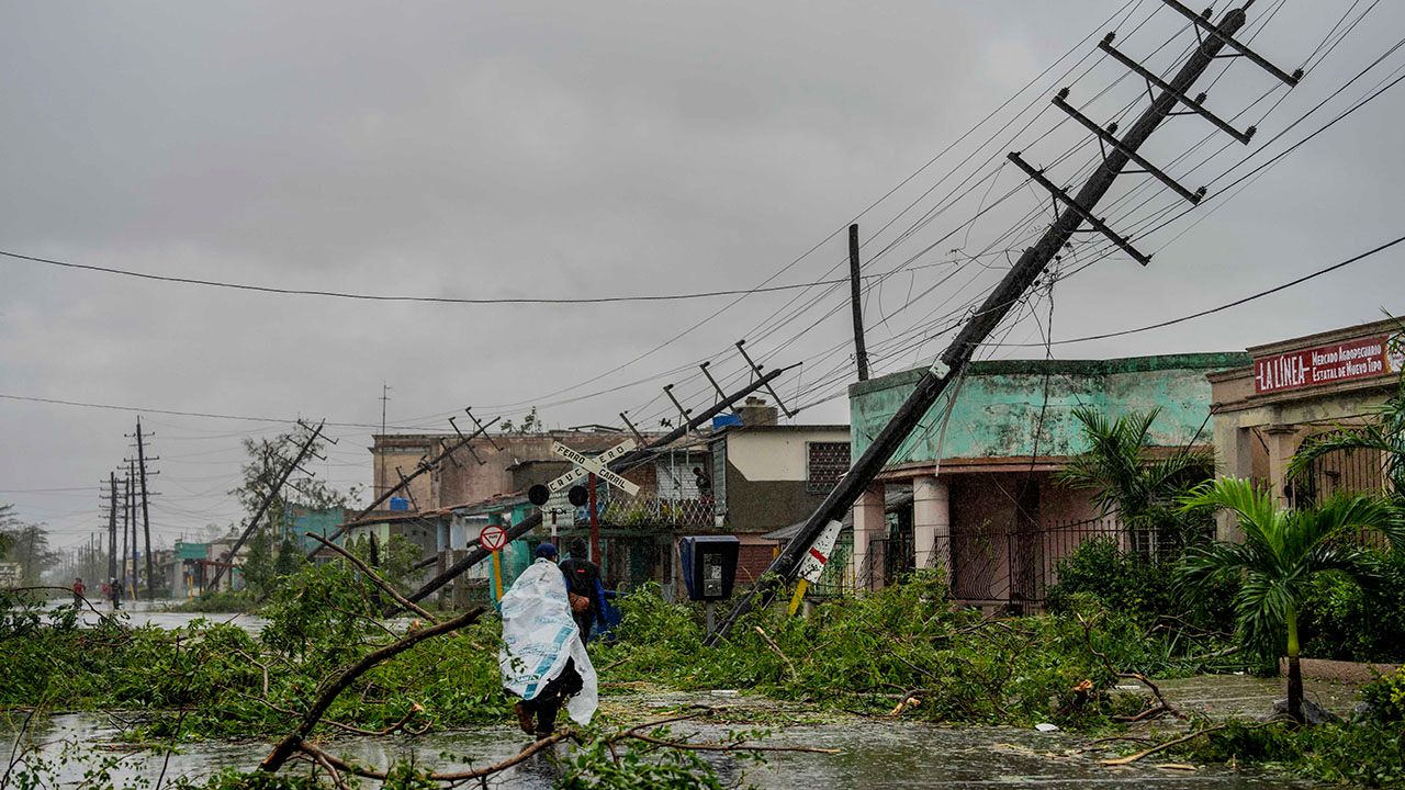
Fallen utility poles and fallen branches line a street after Hurricane Ian hit Pinar del Rio, Cuba, Tuesday, Sept. 27, 2022. Ian made landfall at 4:30 a.m. EDT Tuesday in Cuba’s Pinar del Rio province, where officials set up shelters, evacuated people, rushed in emergency personnel and took steps to protect crops in the nation’s main tobacco-growing region. (AP Photo/Ramon Espinosa)
Ian weakened slightly after passing over western Cuba, but still maintained its major hurricane status as it moved north into the Gulf. After completing an eyewall replacement cycle Tuesday night, Ian became a Category 4 hurricane early Wednesday morning.
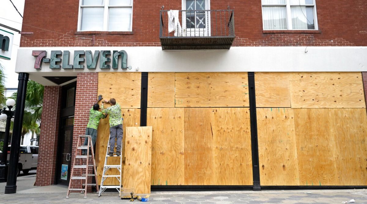
Workers board up the windows of a 7-Eleven convenience store in the Ybor City district in preparation for Hurricane Ian approaches the western side of the state, Tuesday, Sept. 27, 2022, in Tampa, Fla. (AP Photo/Phelan M. Ebenhack)
It made its first U.S. landfall in Cayo Costa in southwest Florida on Wednesday afternoon as a strong Category 4 Hurricane with max winds of 150 mph. After that, it made another landfall in mainland Florida. The second landfall happened just south of Punta Gorda near Pirate Harbor, Fla. with max winds of 145 mph.
Elsewhere in the Atlantic, there is one other tropical depression we are monitoring.
See how the 2022 Atlantic hurricane season has gone so far.