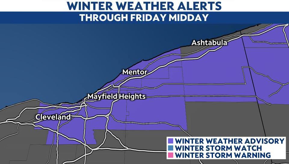
Overnight lake-effect snow showers continue into early Friday. Slowly snow tapers off by lunchtime for areas included in the Winter Weather Advisory.
It’s a slushy and snowy start in Cleveland and the Snow Belt region.
The forecast still calls for snow fall totals up to 2-4 inches. There could be higher totals south of I-90 in Lake County. In Cuyahoga, the higher totals are expected east of I-77 and east of I-271.
Elsewhere, the state is waking up to cold temperatures! Current wind chills are in the lower to mid 20s so bundle up heading out the door! We are expecting some cold sunshine with highs barely reaching the lower 40s.
In NE Ohio, morning lake-effect snow winds down through the afternoon. Travel could still be slow so take it easy, but by this evening, we should be dry. Highs will be in the upper 30s to lower 40s.