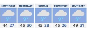
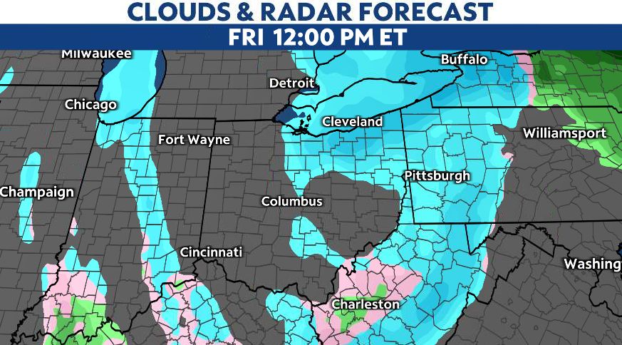
Snow showers through Friday morning with accumulating snow expected in northern Ohio and in the NE Ohio snowbelt region.
What You Need To Know
- Snow showers through Friday morning especially in NE Ohio
- Skies will dry out Saturday and Sunday
- Temperatures slightly improve late weekend with highs Monday into the 40s with rain chances
Conditions will be colder through Friday as highs drop into the 30s. Snow showers are on/off into the afternoon and mainly become lake effect into Friday evening.
Winds play a factor for Friday as wind chills feel colder inthe 20s.
Temperatures stay seasonal chilly through Saturday with drier conditions expected.
Wind chills early Saturday morning, however, will be in the single digits for some. Bundle up!

Highs later in the day rebound into the 30s which is close to average for this time of year. Skies even become partly to mostly sunny at times into the afternoon so not a bad way to wrap up your Saturday.
Slightly warmer by Sunday with clouds rolling in late day. Most stay dry as highs barely brush the lower 40s.
Monday is wet with rain chances returning on Martin Luther King Day grab the umbrella.