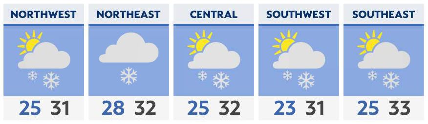
Scattered light snow flurries will continue off-and-on throughout the state through Sunday morning. Impactful accumulations are not likely, but a dusting is possible with a few slick spots at times.
In the primary Snowbelt of Northeast Ohio, however, accumulating lake-effect snow of generally 2-4″ will be possible through early Monday morning.
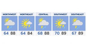
Sunday morning will be cold with lows in the 20s and wind chills in the teens. Highs will struggle to reach the freezing mark.

Hour-by-hour forecast | Share your weather photos | Enable weather notifications | Radar