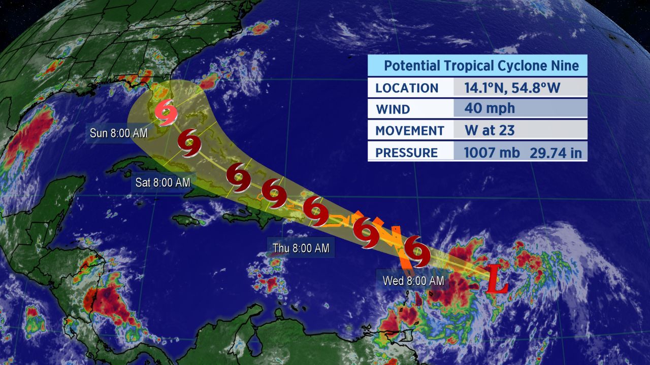
The tropical system we have been watching in the Atlantic has been designated as Potential Tropical Cyclone Nine, and tropical storm warnings were posted for much of the eastern Caribbean on Tuesday.

Forecast track of Potential Tropical Cyclone Nine.
Here we go again.
Fresh off the first landfalling hurricane of the 2020 Atlantic season, another tropical storm is likely to form this week in the central Atlantic Ocean. This storm, currently located over the central Atlantic, has been designated as a Potential Tropical Cyclone by the National Hurricane Center.
A Potential Tropical Cyclone means, in part, that the National Hurricane Center believes the storm has a high probability of turning into a tropical cyclone, and forecast cones, tropical alerts and more can be issued before a tropical cyclone officialy develops.
The next storm on the Atlantic Hurricane list is Isaias. It would become the ninth-named storm of an already hyper-active 2020 Atlantic hurricane season to date.
If Isaias does indeed develop, it’d become the earliest I-named storm on record. The current record earliest ninth-named storm of the season is Irene, which formed back on August 7th, 2005.
If you’re wondering how exactly Isaias is pronounced, here’s a detailed guide on how to properly say it (along with all the other 2020 Atlantic storms.
As of Tuesday, the tropical wave was located about 500 miles east of the Windward Islands.
The spaghetti models, a suite of computer forecast models overlayed on a map, show the storm is likely to gradually turn north as it moves westward across the Atlantic.
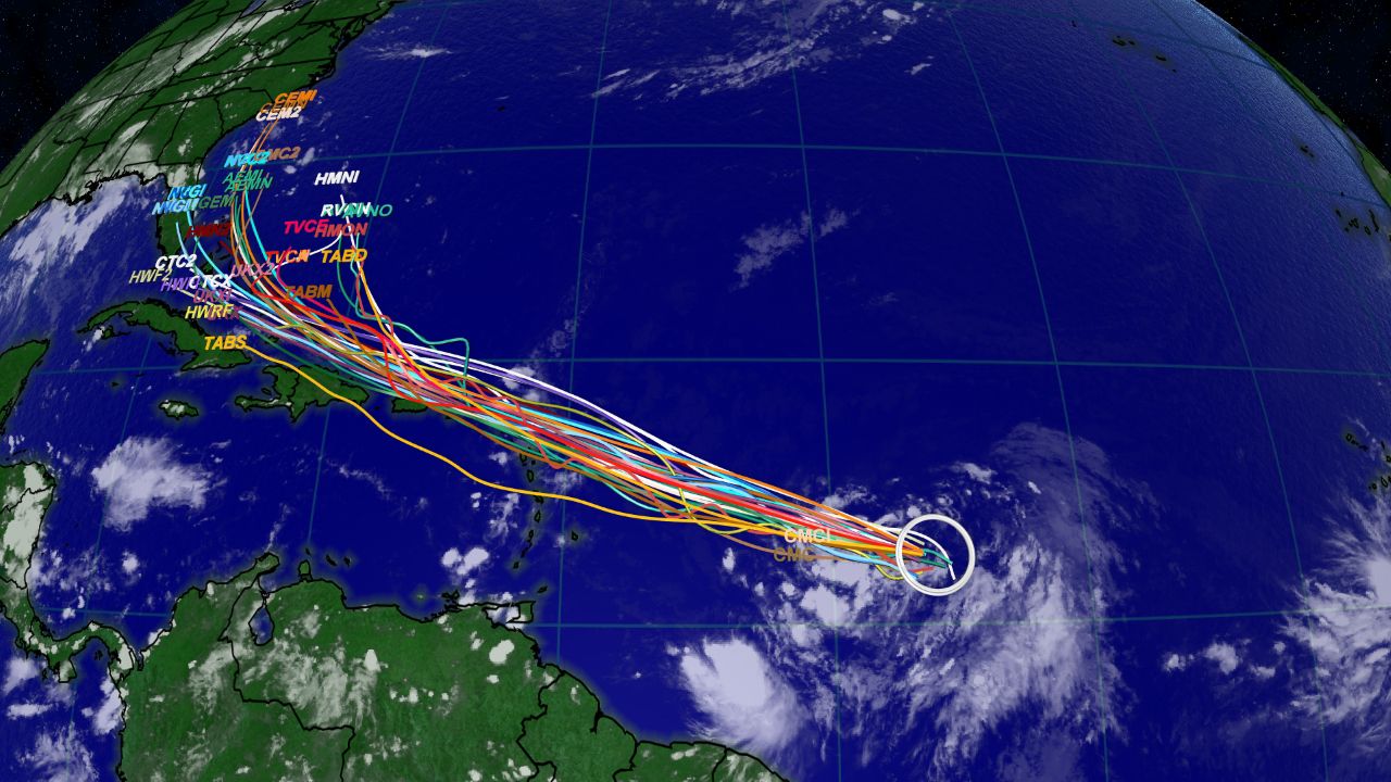
Spaghetti models show a general west-northwest track for the tropical wave.
The system’s first impacts to land could be tonight in the Leeward Islands, where heavy rain is expected. Life threatening flash floods and mudslides are possible.
Tropical storm warnings are in place for Dominica, Puerto Rico, the U.S. and U.K. Virgin Islands, Antigua and Barbuda, Montserrat, Guadeloupe, St. Maarten, Anguilla and St. Kitts and Nevis.
A tropical storm watch was in place for the north coast of the Dominican Republic as well.
Heavy rainfall and gusty wind conditions will spread to the Virgin Islands and Puerto Rico, Wednesday night into Thursday.
Most computer forecast models show the storm slowly strengthening into a tropical storm this week.