A slow-moving storm system, which has brought severe storms to the Southern Plains and Gulf Coast, will bring a threat for strong storms into Ohio on Wednesday.
While showers and storms will be likely throughout the day, I expect stronger storms to push into Ohio Wednesday afternoon.
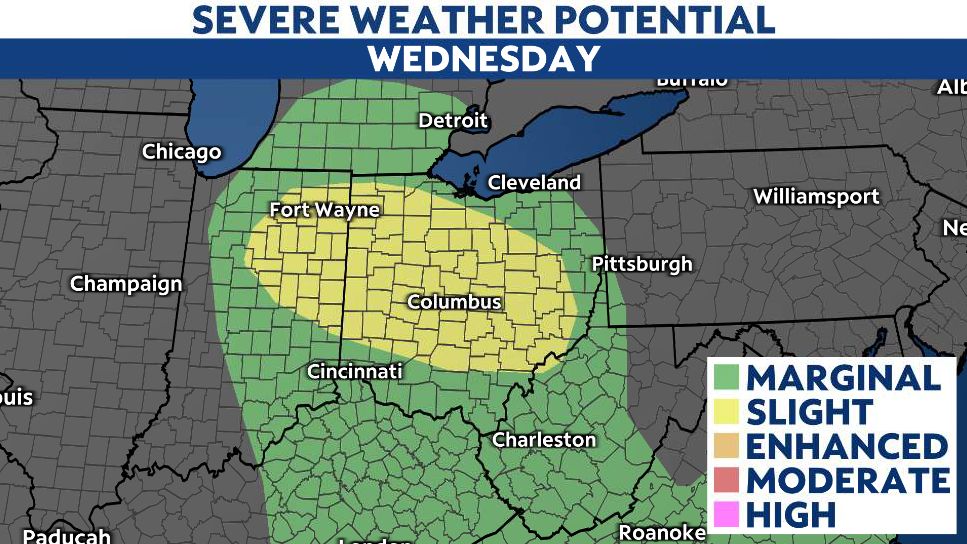
Some storms that develop will have the potential to produce damaging wind gusts and some large hail. There is also a threat for a few brief, spin-up tornadoes.

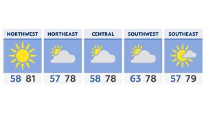
I expect the highest risk for severe storms across west-central, central and southeastern Ohio, where the Storm Prediction Center has placed a slight risk for severe storms. The rest of the state remains under a marginal risk.


The most likely time for the stronger storms will be from noon to about 6 p.m., with storms weakening and exiting the state by sunset Wednesday.

Much cooler air will filter into the state Thursday as the storm system shifts east of Ohio. Unfortunately, the weather will remain active with rounds of showers Thursday and Friday, with even some snowflakes mixing in by Saturday.