Just like last weekend, more active weather will return to the Ohio Valley on Wednesday. To plan ahead and stay alert of the threat, here’s the latest forecast.
There will be an isolated chance of storms Wednesday morning, especially in northeastern Ohio. However, our highest risk of storms will begin after lunch, and will continue to ramp up into dinnertime.
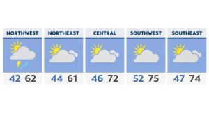
Highs on Wednesday reach the 70s, with higher humidity as well.

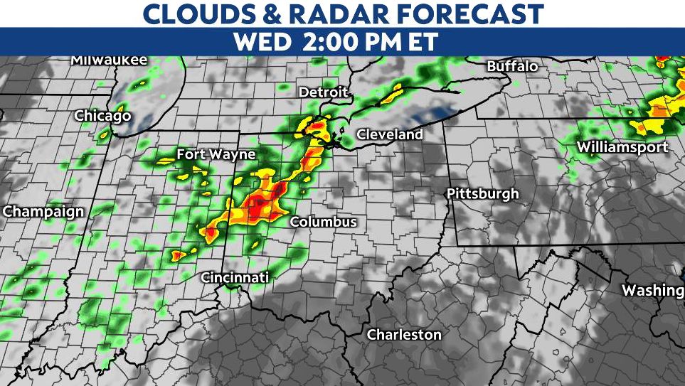
Storms will develop in western Ohio by lunchtime and continue to move across central and northeastern Ohio through the mid-afternoon. Areas in southeastern Ohio will be limited on storm chances until later in the day.
Some storms through early to mid afternoon could become severe with gusty winds and large hail. We can’t rule out a tornado, either.

We’ll have a lull in activity before more storms along the cold front move into the Ohio Valley closer to dinnertime. Once again, storms begin in western Ohio and will become more widespread as they track across the state.

This secondary wave of storms has a higher chance of severe weather, mainly from 4 p.m. through 10 p.m.
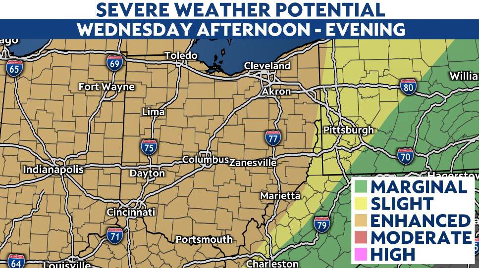
Storms along the front could produce wind gusts over 60 mph, large hail (ping pong ball size) and a tornado.
Here’s an estimate of when storms ought to arrive. Remember, there will be a couple of rounds.

Our team of meteorologists dives deep into the science of weather and breaks down timely weather data and information. To view more weather and climate stories, check out our weather blogs section.