Snow has started in northwest Ohio. Parts of northern Indiana are reporting up to 6 inches of snow in a short amount of time, so this is what we can expect in the coming hours.
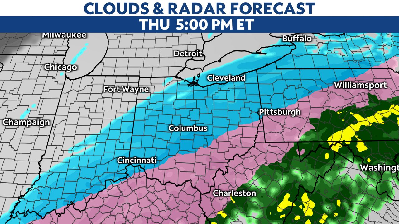
Steady snowfall will slowly move southeast through the evening and overnight but this rain/snow line will not get into central Ohio likely until mid-morning Thursday.
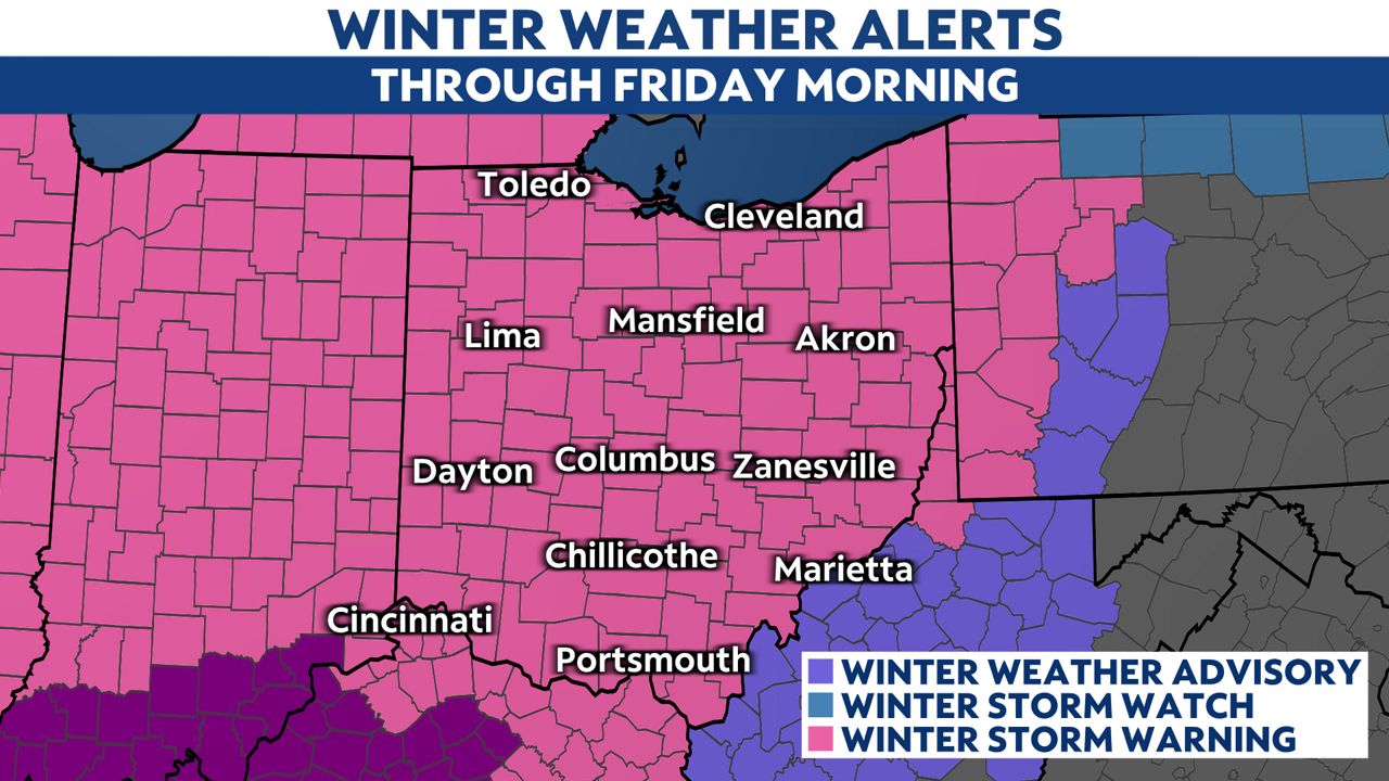
All of Ohio’s 88 counties are under a Winter Storm Warning.
)
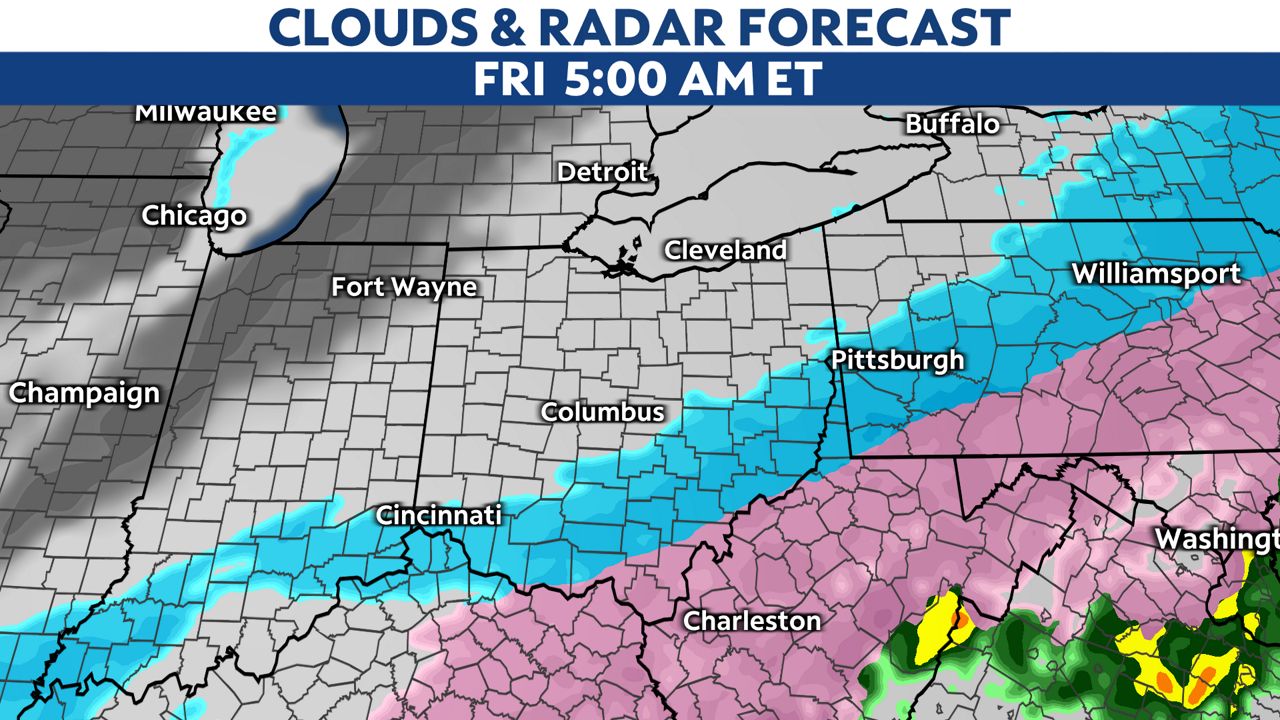
The counties highlighted in purple in Kentucky are Ice Storm Warnings.
Icing throughout Thursday morning will likely lead to school closures and dangerous travel conditions, especially in southern Ohio.
A 1/2 inch of ice is possible between Cincinnati and Porstmouth.
Power outages will be possible with this type of icing.
Central Ohio will likely get around 1/4 inch of ice.
Overnight, the rain will change to sleet and freezing rain in central and southern Ohio.
-6)
This will leave a glaze of ice on roads before sunrise.
This line of icy precipitation will linger even longer in southern Ohio, so snowfall will be less here but ice amounts will be higher.
Once we switch to snow late Thursday, snowfall may become intense at times. This will lead to quick accumulations and bad visibility.
Snow totals from Wednesday through Friday morning will be heaviest north, with 8-10 inches of snow there.
Central Ohio will look at 3-6 inches of snow out of this storm.
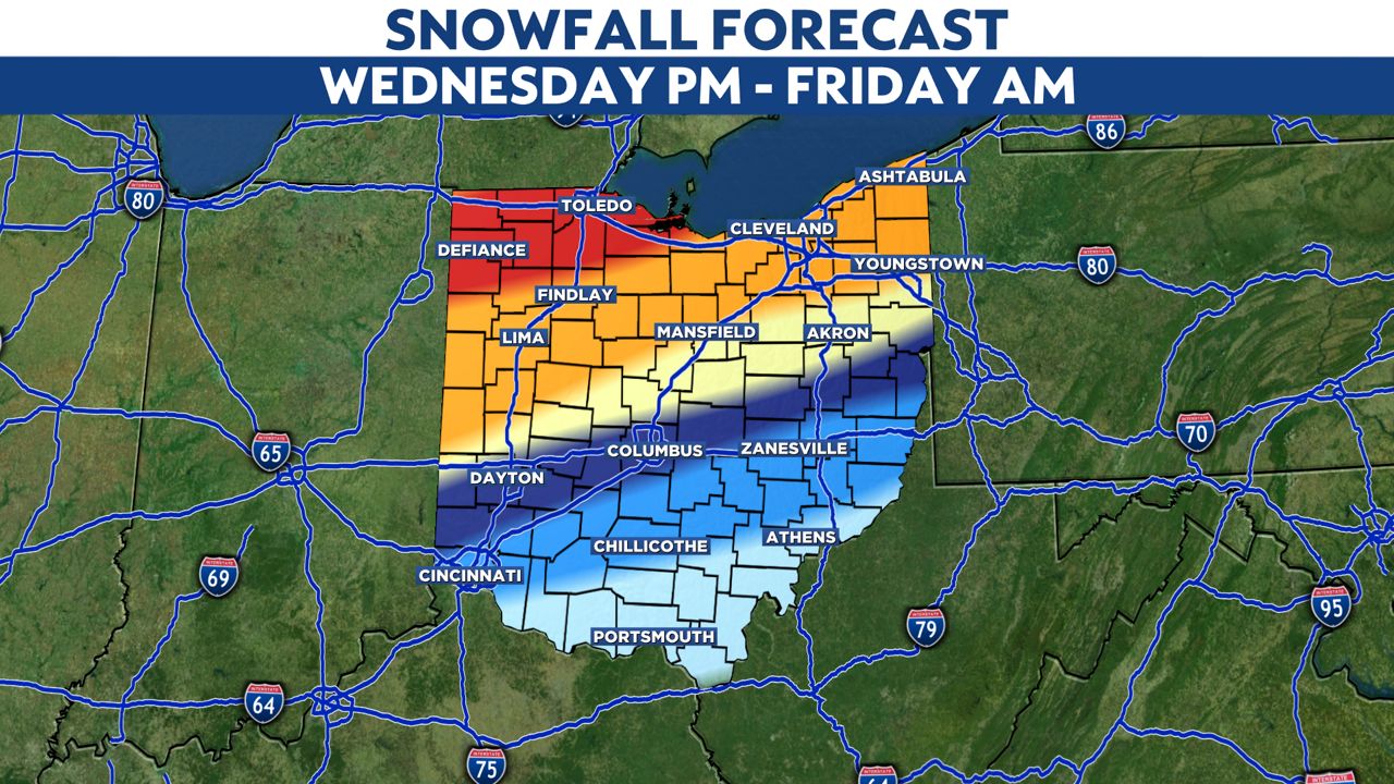
Lower amounts will be in southern Ohio, but ice amounts will be higher.
Winds will get gusty Thursday night so blowing and drifting snow will be an issue.
This storm is now trending later into the day on Friday.
This means additional snow accumulations are likely through Friday afternoon.
Expect very tough travel conditions Friday morning and school closures.
Arctic air, fresh snow and ice on the ground will make things very cold Friday night into Saturday morning.
Actual air temperatures will be below zero in some spots.
Right now though, the weekend will be dry and give us a chance to dig out and recover from this snow and ice event.
Go here to sign up for weather-related notifications on your phone from the Spectrum News app.