A major winter storm is forecast to impact parts of Ohio and much of the northeastern United States Sunday through early next week.
What You Need To Know
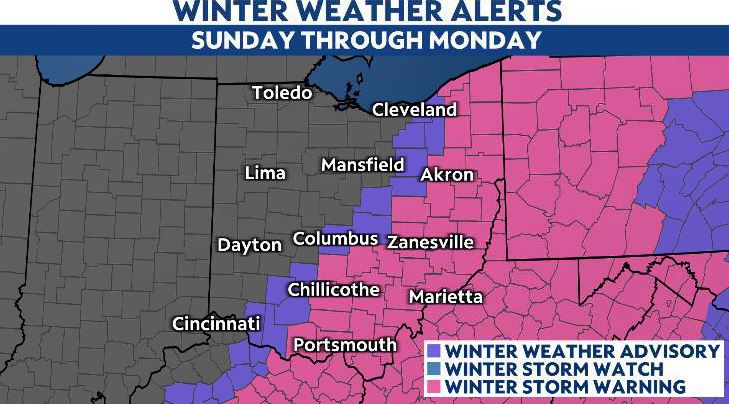
- Winter storm alerts have been issued for parts of Ohio
- Snow to begin in southern Ohio midday Sunday and spread northward
- Monday morning commute likely to have major impacts
The first major winter storm of the season is forecast to impact Ohio beginning Sunday afternoon and lingering into Monday morning. Gusty winds and more snow showers are forecast to cross the state Monday afternoon.
Winter storm alerts have been issued for much of southern and eastern Ohio ahead of the storm.

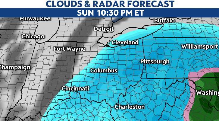
Snow moves in from the south and eventually extends into Northeast Ohio by Sunday evening. A band of heavy snow is expected to set up along and southeast of interstate 71 anc continue to bring heavy snow overnight through early Monday.
Plan on Monday being a messy morning drive as the heaviest snow will have fallen as the commute gets underway. Snow may still be coming down. Many school students will already have the day off due to the Martin Luther King Jr. holiday.
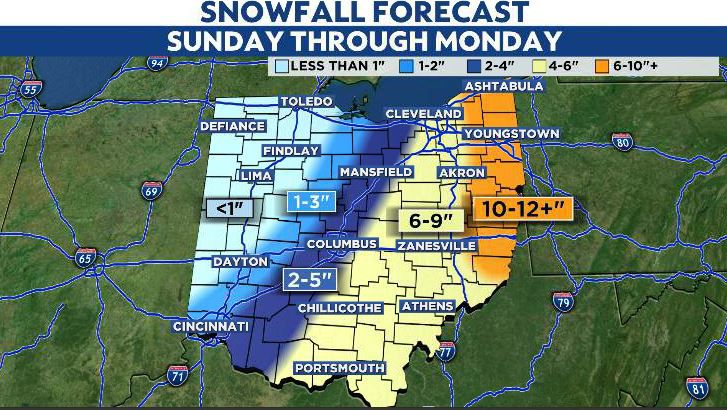
Southeastern and eastern parts of the state will have the highest impact, as measurable snow is likely with the latest forecast. There will likely be a sharp gradient of snow from west to east near the I-71 corridor. Any suttle changes in the storm track could make a large difference to expected snowfall amounts.
Areas of sleet and freezing rain could further complicate travel, especially for southeastern Ohio.
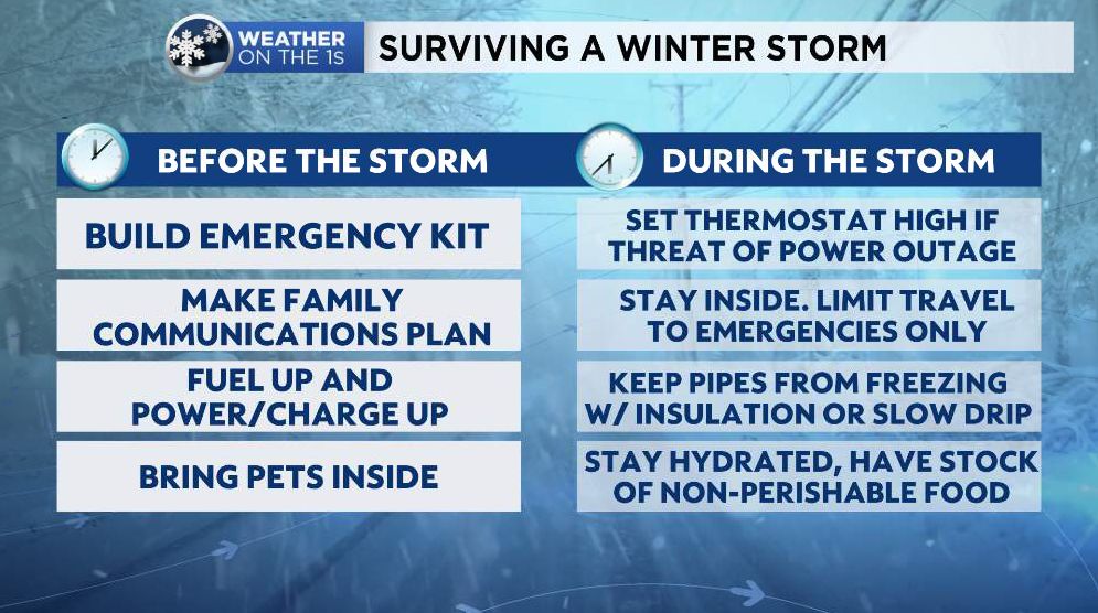
Now is the time to get prepared for the possibility of significant delays or road and business closures due to impactful winter weather. Here are some reminders: