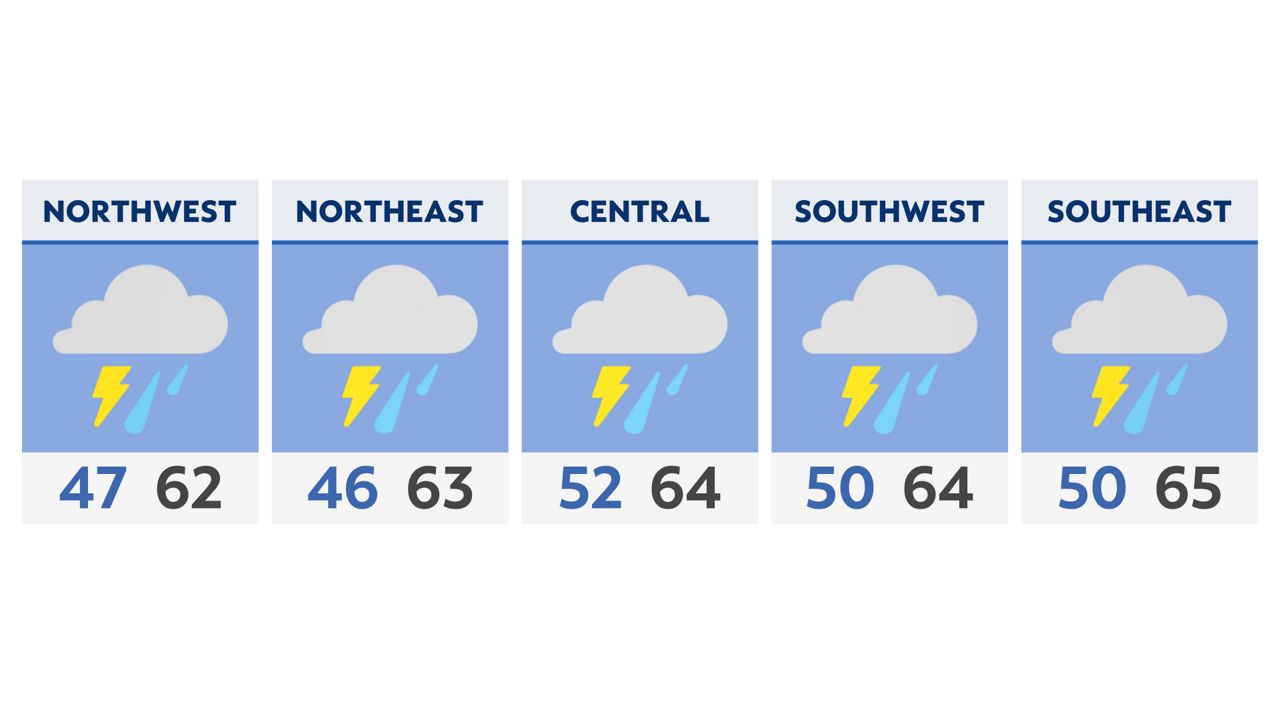
Our severe weather threat should quickly diminish. However, our winds do not.
The powerful cold front sweeps through the state by early afternoon and our wind gusts become our primary concern through the entire day today. Wind advisories and high wind alerts along Lake Erie shoreline will be in effect until this evening.
Gusts could push 30 to 40 for southern and mid Ohio, while strong wind gusts further north up to 50 to 60 mph are possible. Lock down decorations and watch for power outages possible as damage may occur.
On top of that, temperatures fall from the 60s early Saturday into the 40s by early afternoon! Wow get ready for a quick return to reality! Temperatures drop into the 30s tonight as lake effect snow is possible in the snowbelt region in NE Ohio.
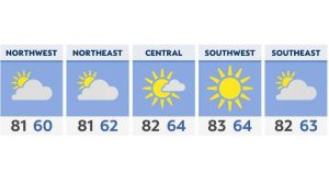
Sunday is cooler, but calm as the sunshine is back. Highs are only in the 40s.
Read more about the active weather here.
-2)