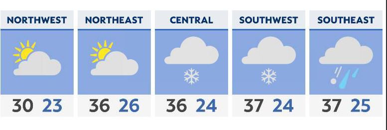
Here comes the snow!!
Some mixing with ice is possible for southern and southeastern Ohio, but everything transitions over to snow after dinner time as temperatures drop to freezing or lower.
Heavy snow begins to become an issue for roads and traveling as early as this evening. Snowfall rates could be 1-2 inches per hour into tonight as widespread heavy snow continues especially in eastern and central Ohio.
Early Monday additional snow sweeps across the state with more heavy activity in NE/E Ohio until lunch. As the storm complex exits Monday our winds become stronger with gusts up to 20 to 30 mph. We’ll have the potential for blowing snow especially for areas with a lot of snow on the ground to reduce visibility.
Lake effect snow begins late Monday for NE Ohio which will pile on MORE snow in NE/E Ohio from late Monday through early Tuesday.

Click here for the latest 7-day forecast | Click here to share your weather photos