We are tracking another round of severe weather and heavy rain for parts of Ohio as we continue to clean up after flash flooding Wednesday for northern Ohio.
A Tornado Warning is in effect for Erie and Sandusky counties unitl 11:45 p.m. Seek shelter.
More than 12,000 Ohio residents are without power, according to poweroutage.us.
What You Need To Know
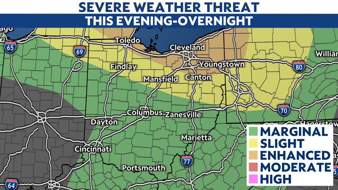
- A rare enhanced risk of severe weather is up for Toledo and Cleveland
- Severe storms and flash flooding are possible
- Storms are expected to last through 5 a.m.
- Tornadoes, hail and winds up to 70 mph are possible
For the second night in a row, a complex of storms with the capability of producing very heavy rainfall will move in from the northwest.
-3)
An enhanced risk (level 3/5) for severe weather includes Toledo, Cleveland and Akron.
This means many severe storms are possible.
Storms may move in between 10 p.m. – 11 p.m. Thursday.
-10)
The threat of flash flooding is just one threat. This storm system could bring in all modes of severe weather.
Storms could also produce damaging winds up to 70 mph, tornadoes and hail.
While we must stay vigilant to additional flash flooding, these storms may not be as slow or stationary as we saw last night.
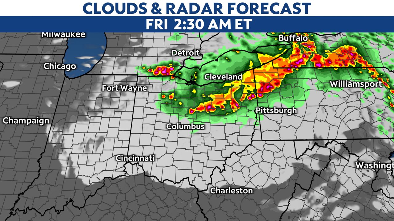
Storms should weaken as they move south into central Ohio but isolated downpours and gusty storms will be possible in central and southern Ohio.
-2)
Make sure you have a way to get warnings on your phone before you go to sleep.
Storms will move south early Friday morning and we are only expecting isolated showers Friday.