After rain and a few storms in Ohio Tuesday morning morning, more develop this afternoon and evening.
After an initial round of mostly showers with a few rumbles of thunder in the morning, the threat for severe storms ramps up early this afternoon.

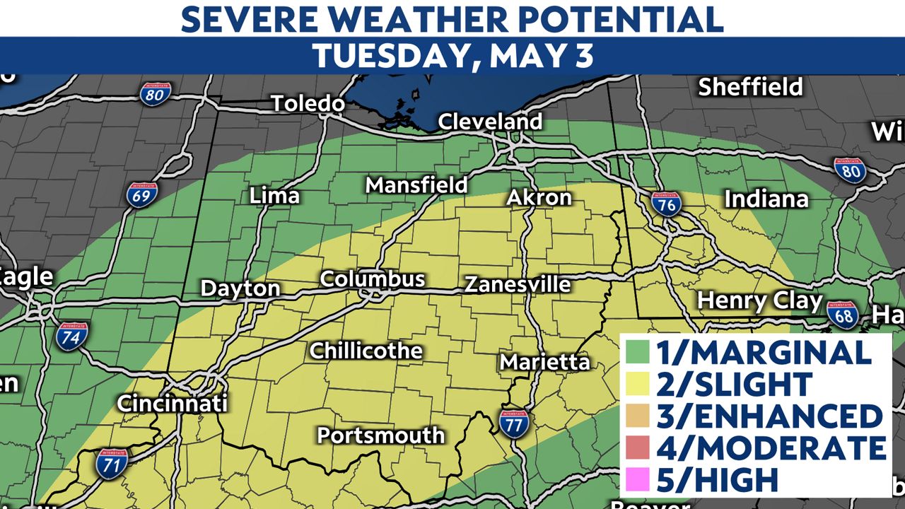
The Storm Prediction Center has placed much of Ohio under a “slight risk” for severe storms. Damaging wind gusts are the mostly likely threat with the strongest storms. However, large hail, heavy rainfall, and even an isolated tornado cannot be ruled out.
The tornado threat is higher in southeastern Ohio than elsewhere in the state.
Turn on your severe weather notifications in the Spectrum News app so you’re ready and weather-aware.

The greatest threat for severe storms is expected between 2 p.m. to 8 p.m. Storms are forecast to weaken near sunset Tuesday before pushing out of the state in the late evening.
Spectrum News 1 will cover any severe weather live on-air and on the Spectrum News App.