If you have been missing fall, it is right around the corner! We are expecting a huge temperature shift this upcoming weekend. However, before we break down those numbers, let’s dive into our storm chances for Friday.
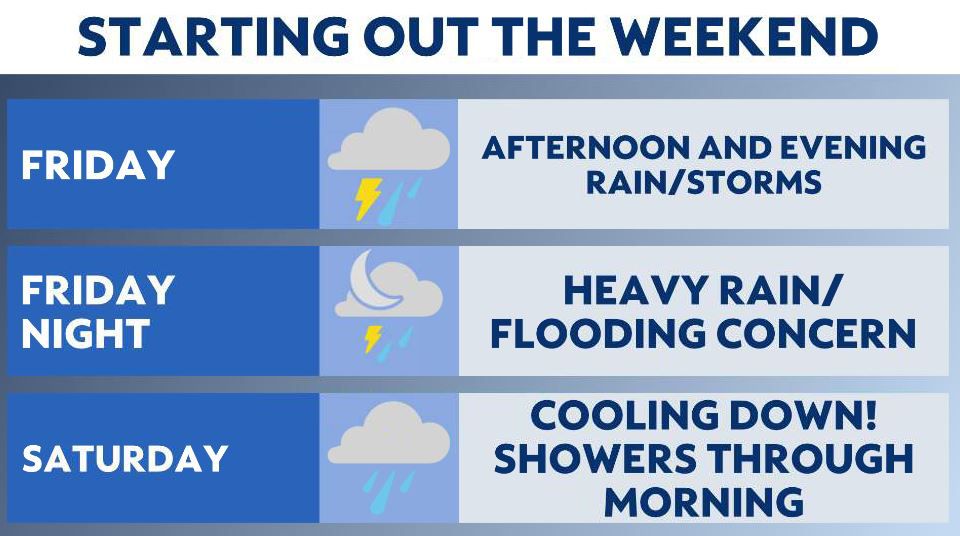
Friday brings unseasonable warmth along with scattered showers moving through the state. Rain chances are mainly on/off before lunchtime with warmer-than-normal temperatures and mainly cloudy skies.
The threat for severe weather increases after lunchtime.
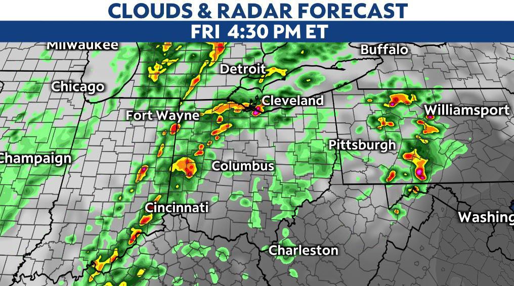
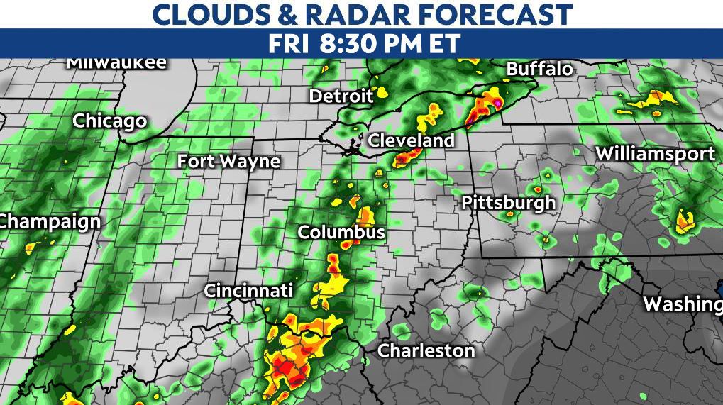
We’ll watch for more rain and storms to fire up during the afternoon and evening timeframe.
There is a statewide risk for severe storms, but the area of concern about 40 miles either side of the I-71 corridor. From the Miami Valley to the Cincinnati metro, northeastward through Columbus and into the Cleveland metro area, there’s a slight risk on Friday. (level 2 out of 5)
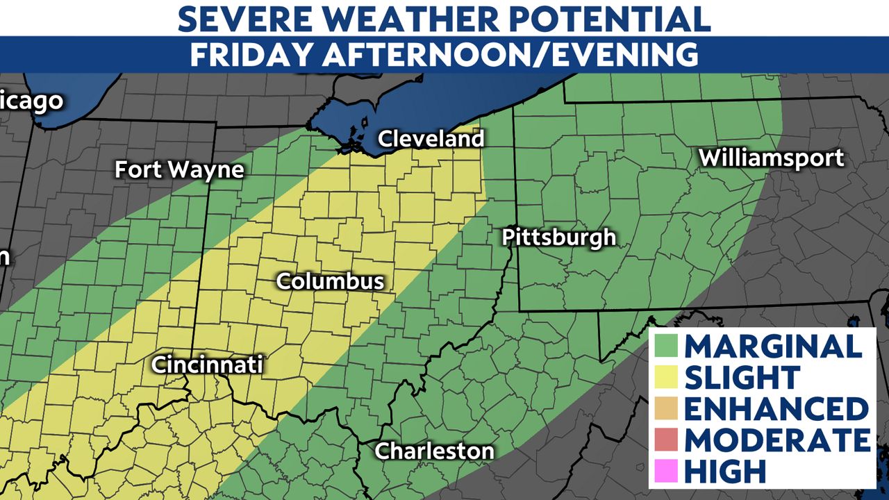
Our atmosphere will be ‘juiced up’ with higher moisture content and warmer temperatures ahead of the front. This will increase atmospheric instability, allowing for storms to strengthen and potentially become severe Friday afternoon and evening.
Winds pick up along the front too.
Storms could produce high winds and heavy pockets of rain. We can’t rule out a few tornadoes, but the threat for damaging winds remains the biggest concern. Potential gusts could reach up to 50-60+ mph.
Widespread rain ramps up overnight Friday while it is dark. This increases concern for drivers. Remember, if you encounter water on the roadway, turn around, don’t drown.
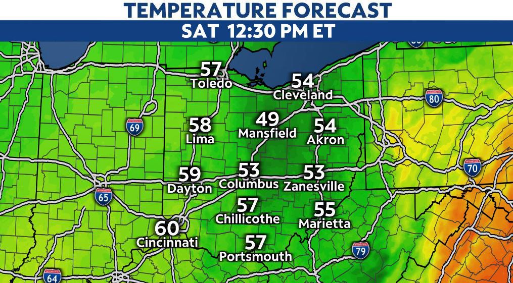
The cooler air begins to rush in Saturday morning, decreasing our potential for storms.
We will mainly be tracking showers, but much of the day will stay breezy, cloudy and wet with temperatures nearly 20 degrees cooler. Highs will only reach into the 50s to near 60, so be prepared to bundle up!
The winner this weekend is Sunday as we dry out with seasonal highs in the 60s.