Tropical Storm Cindy formed late in the central Atlantic on June 22, becoming our third named storm of the season.
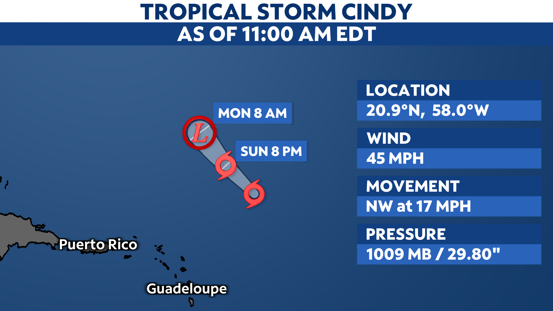
Cindy continues move toward the northwest, staying well north and east of the Leeward Islands.
Even though it remains a tropical storm with maximum sustained wind speeds of 45 mph, Cindy will continue to weaken due to increasing wind shear. By Monday, it is expected to become a remnant low.

Cindy could generate rough surf, but other than that, it will stay far enough away from the Leeward Islands. No watches or warnings are in effect.
For a look at the 2023 Atlantic season so far, click here.
Our team of meteorologists dives deep into the science of weather and breaks down timely weather data and information. To view more weather and climate stories, check out our weather blogs section.