Lake-effect rain and snow will pick up in intensity after sunset Tuesday night so light accumulations are possible in the primary snowbelt. This could impact local travel through Wednesday morning, allow some extra time!
Check out the video above: graupel falling in Lake County (east of Cleveland) earlier today.
This happens when an icy layer forms around snow crystals.
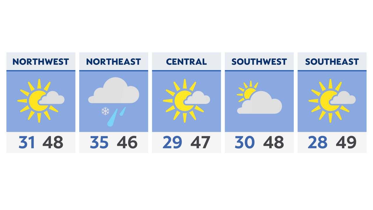
Forecast:
Sure feels like winter with morning lows near freezing early Wednesday. There’s freeze warnings for southern Ohio until 10 am with frost and freeze possible. Temperatures could drop down to the upper 20s!
Plus our first round of snow happened yesterday in the snowbelt. Additional snow showers overnight are expected to continue today with some mixing possible, but watch for travel to be impact.
Elsewhere skies are mostly to partly sunny as temperatures stay below average this afternoon in the 40s.
)