Expect another hazy, hot and humid Sunday after a very muggy and stuff Saturday night. Once again, we’re watching for a slight chance of showers and storms NW overnight, with most of the state staying dry.
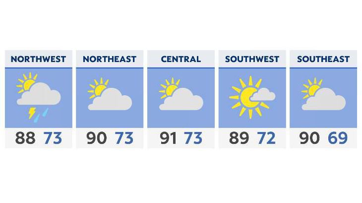
Sunday morning will bring us south winds at 10-20 mph which, despite some more cloud cover in spots, will help bring temperatures well into the upper 80s and low 90s by the afternoon. With the heat and humidity combined, afternoon heat index values could easily be in the middle 90s for much of the Buckeye State. Sunday evening, a slight chance of showers and storms across west and northwest Ohio exists, although once again most areas will remain dry.
Unsettled weather starts off next week, with a “reset and recharge” pattern of afternoon and evening showers and storms each and every day. It will be very warm to hot, with highs closer to 90 than 80 through Wednesday; after that, we cool off as a frontal boundary drops south.