We’re starting off dry this morning, but storms are back in the forecast by this afternoon.
What You Need To Know
- Isolated strong/severe storms will be possible this afternoon and evening
- Very warm before storms arrive
- Gusty winds also likely
Isolated storms will start to pick up around midday, but we’ll really see storm chances ramp up during the late afternoon/early evening timeframe, beginning with western Ohio.
Eastern Ohio especially will be very warm this afternoon before the arrival of the storms with 80s in the forecast. Areas farther west will see more low to mid 70s.
Storms should move into our western counties by around 3-4 p.m., spread to Columbus around 6-7, and arrive in Cleveland closer to sunset tonight.
Isolated severe storms are likely, with the primary threat being damaging straight-line winds. An isolated tornado cannot be completely ruled out.
Another round of showers arrives tomorrow, along with cooler temperatures back in the 50s and 60s.
Dry Pattern Ahead After Weekend
While we will see some active weather through the weekend, sunnier days are ahead!
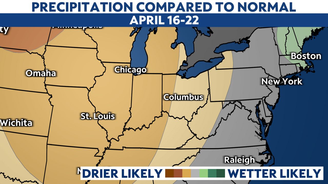
Take a look at our rain chances from April 16-22.
After Sunday, we will get into a drier than normal period.
If it gets too dry you might have to water!