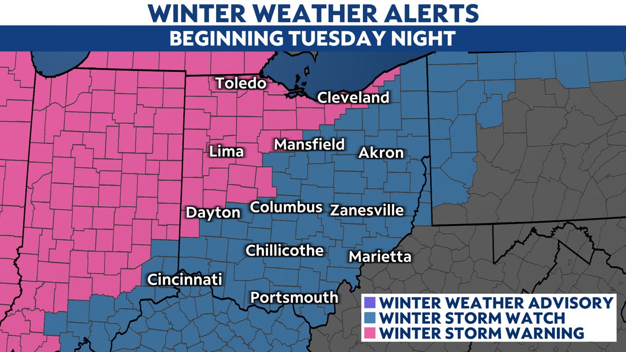
Our big winter storm will likely bring some very difficult, if not impossible, travel conditions at times from Wednesday afternoon through early Friday.
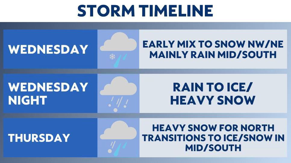
This winter storm will be a prolonged event, lasting over two days and bringing a variety of precipitation types to Ohio.
)
Accumulating snow will begin early Wednesday in northwest Ohio.
It’s possible the Toledo area could have 2-3 inches of snow on the ground before 9 a.m.
Heavy snow will move into north-central and northeast Ohio through the afternoon.
Rain will be the main precipitation threat for central and southern Ohio through the evening.
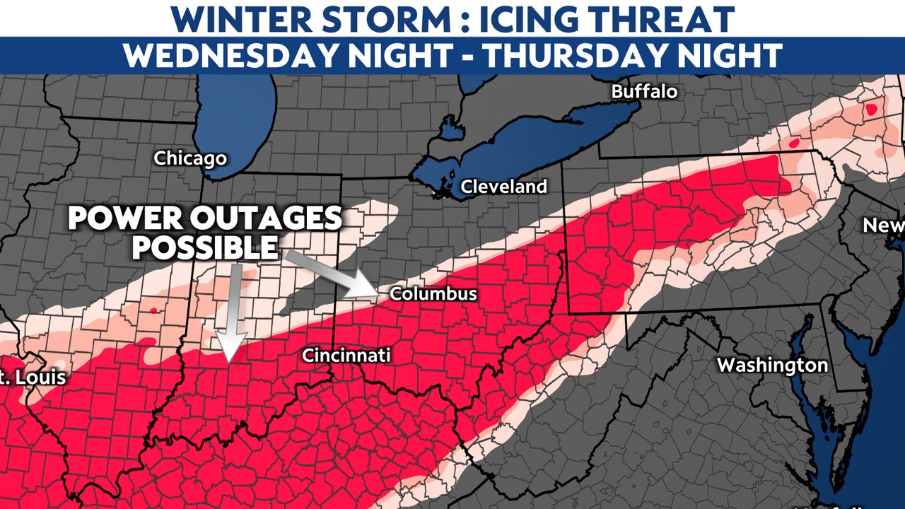
A line of freezing rain and sleet will expand as it moves into central Ohio in the overnight hours leading into Thursday.
We could have several hours of icing, so we do not recommend traveling early Thursday.
0.25 to 0.5 inches of ice is possible in central and southern Ohio. This could cause numerous power outages.
The tree limbs and power lines will be weighed down by snow Thursday, and expect windy conditions.
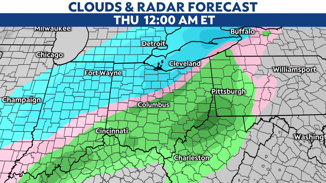
The most dangerous time for this storm looks to be overnight Wednesday into early Thursday.
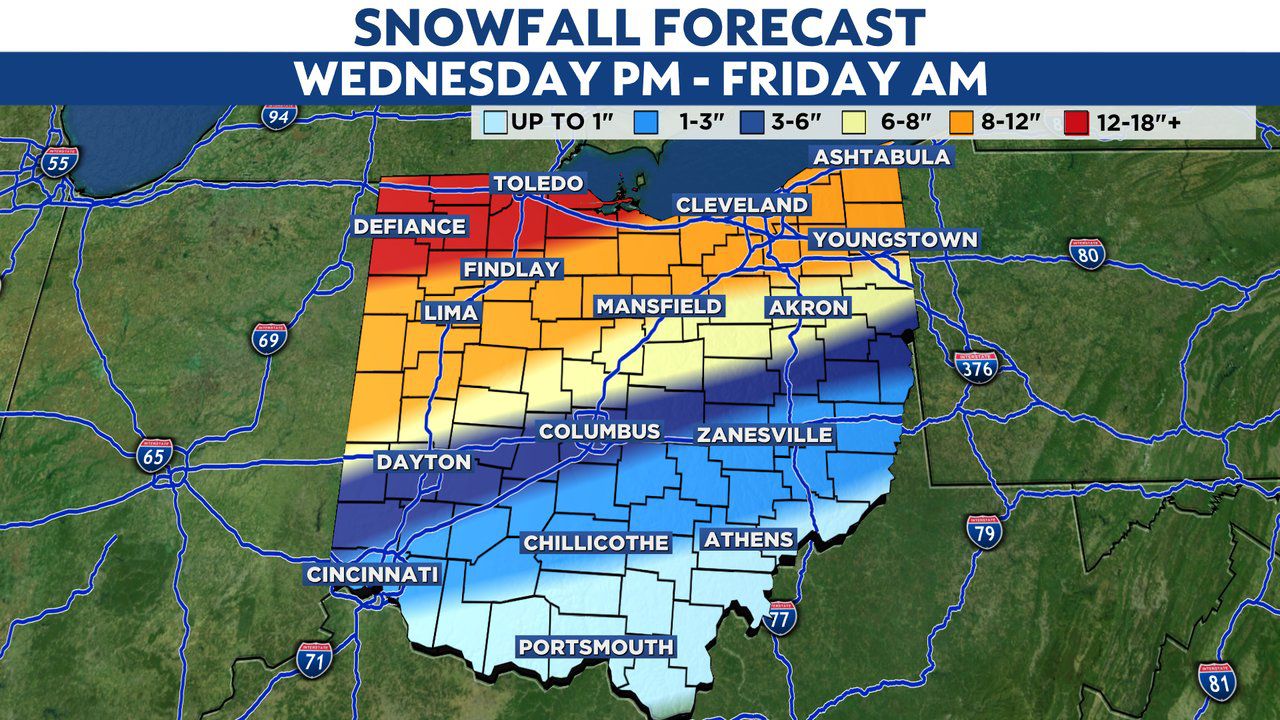
The highest snowfall will be in northern Ohio. Toledo could end up with 18 inches of snow while Columbus is looking at 3-6 inches and Cleveland about 8 inches.
Much colder air and gusty winds will come in Thursday.
This means blowing and drifting snow could create further issues on the roads.
With temperatures expected to drop rapidly Thursday night, a flash-freeze will be possible, changing any standing water to ice.
This storm will really be a double threat of heavy snow and ice.
The icing on the branches with snow and gusty winds could create power outages even after the icing stops.
Bottom line, make sure you stay home if you can, and always stay away from downed power lines and report them immediately.
Go here to sign up for weather-related notifications on your phone from the Spectrum News app.