Round one moves out, and round two is on deck.
What You Need To Know
- Patchy fog Thursday morning then skies clear by lunch
- Pattern change into the weekend with cooler and less humid conditions
- More rain coming in for Friday and early Saturday
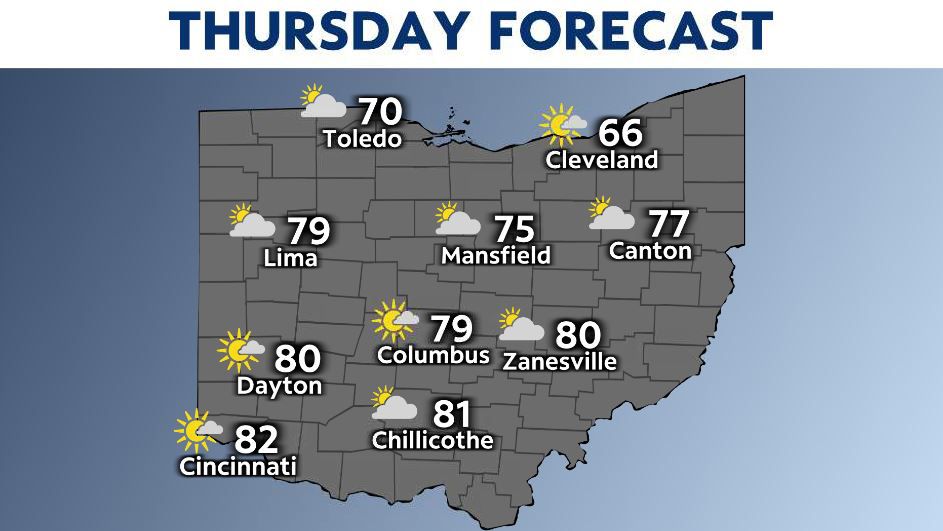
Thursday morning patchy dense fog is possible and could reduce your morning visibility so allow yourself some extra time heading out the door this morning. Meanwhile, once the fog lifts by late morning skies will be bright and sunny for most of the day!
Highs are comfortable and cooler through the state. Northern Ohio stays in the 60s this afternoon and it’s warmer to the south pushing 80.
Showers and storms begin to return later this evening/tonight with maybe a few stronger storms in w/SW Ohio. Our chances become more widespread overnight as the low pressure system inches closer to our area.
This sets up for our second round of wet weather this week Friday. Grab the umbrella and the rain jacket!
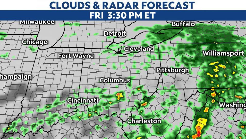
Morning showers likely followed by rounds of rain and thunder through the day.
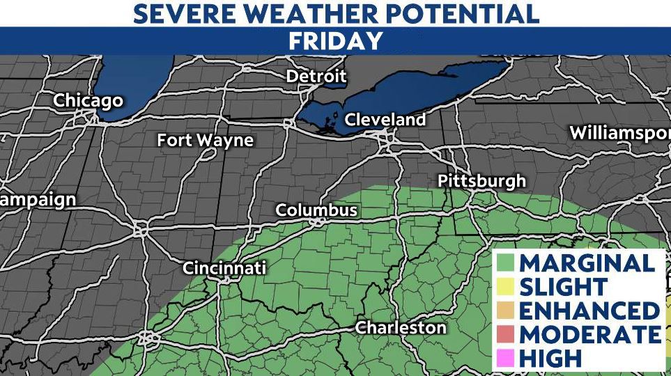
A marginal risk is in effect Friday so some stronger storms are still possible with heavy rain and gusty winds as our main threats. Highs only reach the 60s and 70s.
Best chance of storms will be through the afternoon and early overnight hours.
Some showers linger into Saturday’s forecast, and then the rest of our Memorial Day weekend looks sunny, dry and seasonal in the 70s.

A look back: 2nd anniversary of the Memorial Day tornado
On May 27 2019, 21 tornadoes ripped through the Ohio valley and became a day forever remembered in Ohio history.