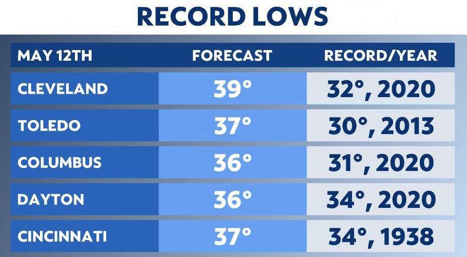
Unseasonably cool conditions continue through tonight. Some places could be dropping close to record lows!
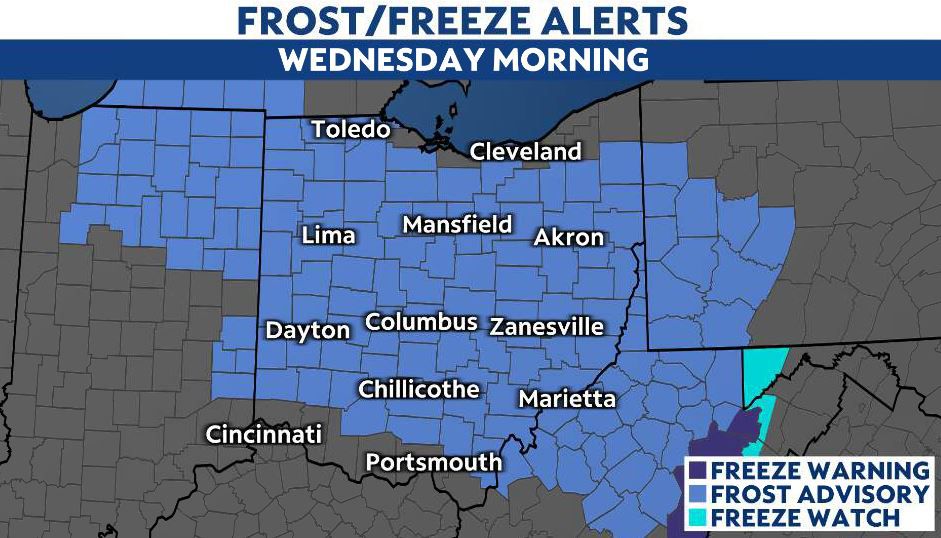
Areas of frost are possible early Wednesday morning, so protect those plants!
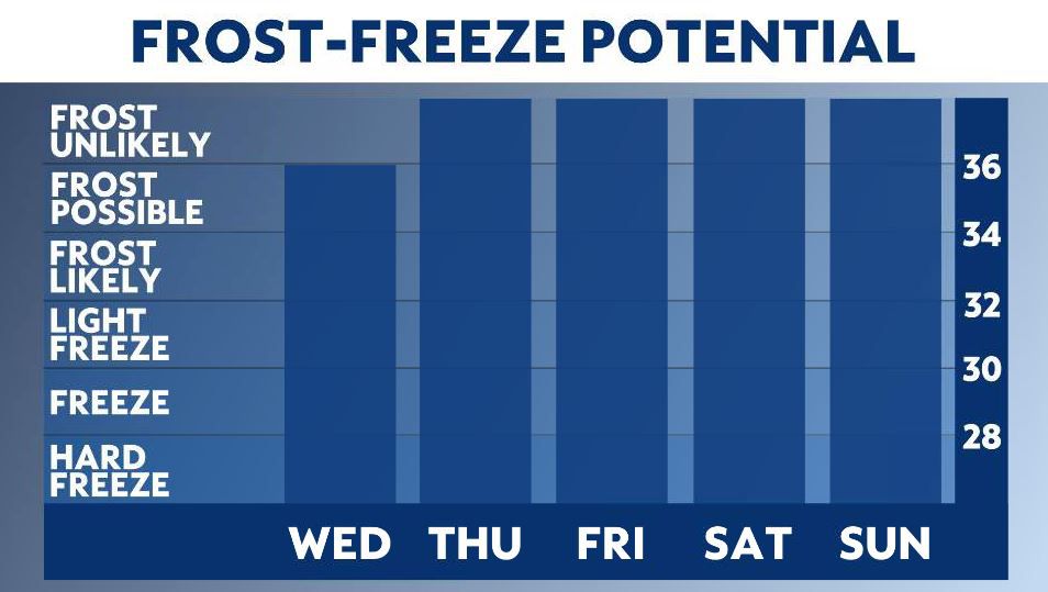
A Frost Advisory is in effect for most of the state overnight.
Temperatures stay below average through the day Wednesday, but they’re slightly milder than yesterday in the upper 50s to lower 60s.
A large area of high pressure continues to keep our weather calm and dry mid-week, so we aren’t expecting any rain chances. Eventually the high pressure system shifts east, which will shift our winds out of the south.
As our winds shift, our temperatures will slowly rise.
On Wednesday night, lows drop into the upper 30s to low 40s and some frost may develop as a result. But, it isn’t as likely to have an impact on vegetation as tonight’s.
Thursday is slightly milder in the mid to upper 60s and closer to average. And finally, for Friday, highs push 70!
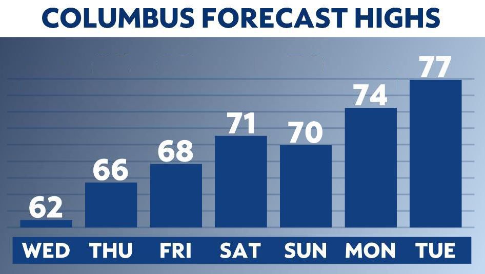

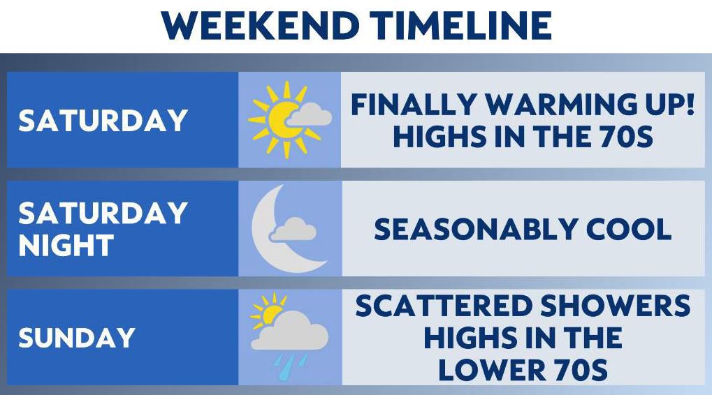
This week is quiet with cool conditions becoming milder later this week as May temperatures return this weekend!
May warmth makes a return this weekend
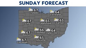
We will see above-average temperatures heading into next week. This could mean it may finally be time to do some spring planting.