Temperatures will remain well above average heading into the week ahead.
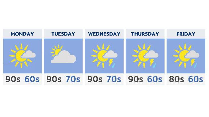
The hot and humid weather from the weekend will continue right into the start of the workweek, with temperatures soaring past the 90 degree mark in many areas.
Even with a few spots slightly cooler near and around the lakeshore, the humidity will make it feel much hotter. Look for heat index values to be well into the middle 90s for many places south of I-70.
Available moisture is limited Monday and Tuesday, with mostly sunny to partly cloudy skies.
By the middle of the week, expect an approaching front to help draw up some showers and storms, particularly in the afternoon. While widespread severe weather isn’t likely, we could very well see a few strong storms late Wednesday, Thursday and even early Friday.
By the end of next week, we’re expecting a slight cool-down, although temperatures will remain average or even slightly above well into next weekend.