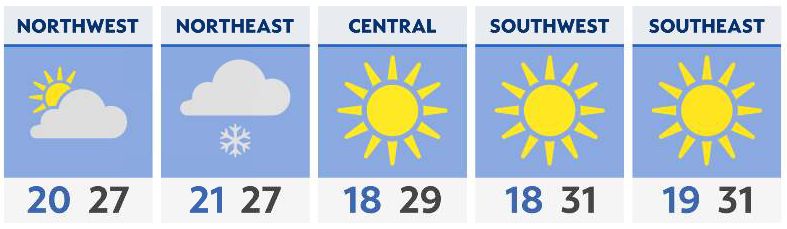
NE Ohio
Heavy lake-effect snow kicks into gear and continues through much of Sunday. Areas around Cleveland and into the Snowbelt should expect hazardous weather.
The potential of 4 to 12 inches of snow, with locally higher totals, exists for the second half of the weekend. An additional concern is the blowing and drifting snow potential, as wind gusts could reach 45 mph along the lakeshore and up to 35 mph further inland. Travel may become quite hazardous at times.
Elsewhere in Ohio
Much quieter than areas further north. A cold front knocks temperatures back into the teens for lows and 20s for highs on Sunday. Gusty west-northwest winds will keep things feeling colder. Wind chill values will be in the single digits and teens. Plenty of sun is expected to start the week.

Hour-by-hour forecast | Share your weather photos | Enable weather notifications | Radar