Hurricane Laura intensified quickly overnight and is now a major Category 4 hurricane, and it could be one of the strongest storms to strike the northern Gulf Coast in recent memory.
Laura is expected to make landfall Wednesday night along the southeastern Texas or southwestern Louisiana coastline, and hurricane warnings are in place there ahead of the storm.
Laura Continues to Strengthen
Laura formed in the central Atlantic on Friday and has since moved into the Gulf of Mexico where it quickly strengthened into a hurricane.
Hurricane warnings run from San Luis Pass, Texas to Intracoastal City, Louisiana. Storm surge warnings are in place from Freeport, Texas to the mouth of the Mississippi River in Louisiana.
On Wednesday morning, the National Hurricane Center referred to the storm surge threat from Laura as “unsurvivable”. Up to 20 feet of storm surge could flood much of southwestern Louisiana and far southeastern Texas.
Tropical storm warnings are also in effect on either side of those warnings.
The governors of both Lousiana and Texas have preemptively declared disaster orders as they urge residents to monitor the forecast.
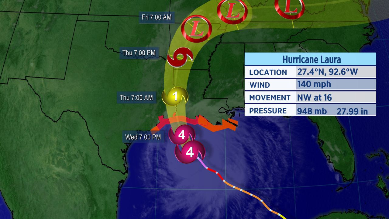
Forecast cone for Hurricane Laura.
Warm water and light wind shear will help it strengthen even more prior to landfall. Laura could have sustained winds approaching 155 mph at landfall later tonight.
Most likely arrival time of tropical storm-force wind.
Tropical storm-force winds are looking to arrive by this evening. Final preparations and evacuations should be rushed to be completed over the next few hours.
Laura is a large hurricane, so strong winds will extend far from the center and beyond the forecast cone. Hurricane-force winds reach as far as 60 miles from the storm’s center, and tropical storm-force winds are up to 205 miles away.
Catastropic storm surge and heavy rain will also accompany Laura. Reasonable worst-case storm surge is 10 to 20 feet above ground level near the landfall location, and flooding could spread far inland.
Even though Laura is forecast to affect a sizeable share of the Gulf Coast, the exact landfall location is still uncertain. That said, it is likely that the storm will make landfall near the Texas and Louisiana border as a Category 4 hurricane tonight.
You can track the storm on the ground by monitoring webcams across the impacted region.
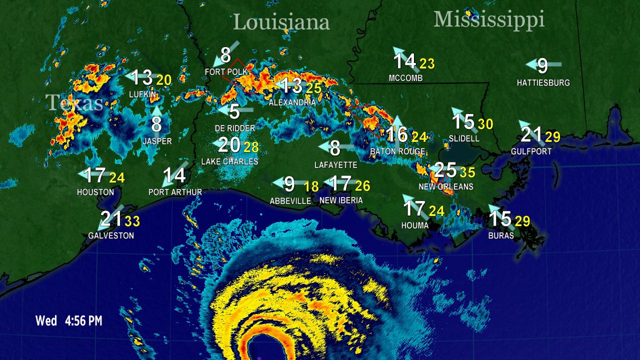
The eye of Hurricane Laura, as seen from Doppler Radar Wednesday afternoon.
Category 4 Landfalls Are Rare
Since 1851, only 26 hurricanes of a Category 4 or 5 strength have made landfall on the continental United States. That means that a Category 4 or 5 landfall on the United States takes place only once every six or seven years.
Since 1851, Louisiana has had only three Category 4s make landfall, according to Colorado State Univeristy hurricane researcher Dr. Phil Klotzbach.
No Category 5s on record have hit the state, according to Klotzbach.
Since 1894, Louisiana has only seen one Category 4 landfall, Hurricane Betsy back in 1965.
Klotzbach also noted that Laura is the strongest August Gulf of Mexico hurricane since Hurricane Katrina in 2005.
Setting Records
Laura became the earliest “L” named storm to ever form in the Atlantic, and an M-named storm had never formed in the month of August in the Atlantic before Marco.
These storms follow what has already been a record-setting season in the Atlantic.
With 13 storms already this year, this is the fastest start to an Atlantic hurricane season in recorded history. The climatological peak of hurricane season is in mid-September.
Since Marco made landfall on Tuesday, the tally this year is now six. If Laura tracks as expected, its landfall will be the seventh.
With Laura’s impending landfall on the Gulf Coast, here are five things you might not know about hurricanes.