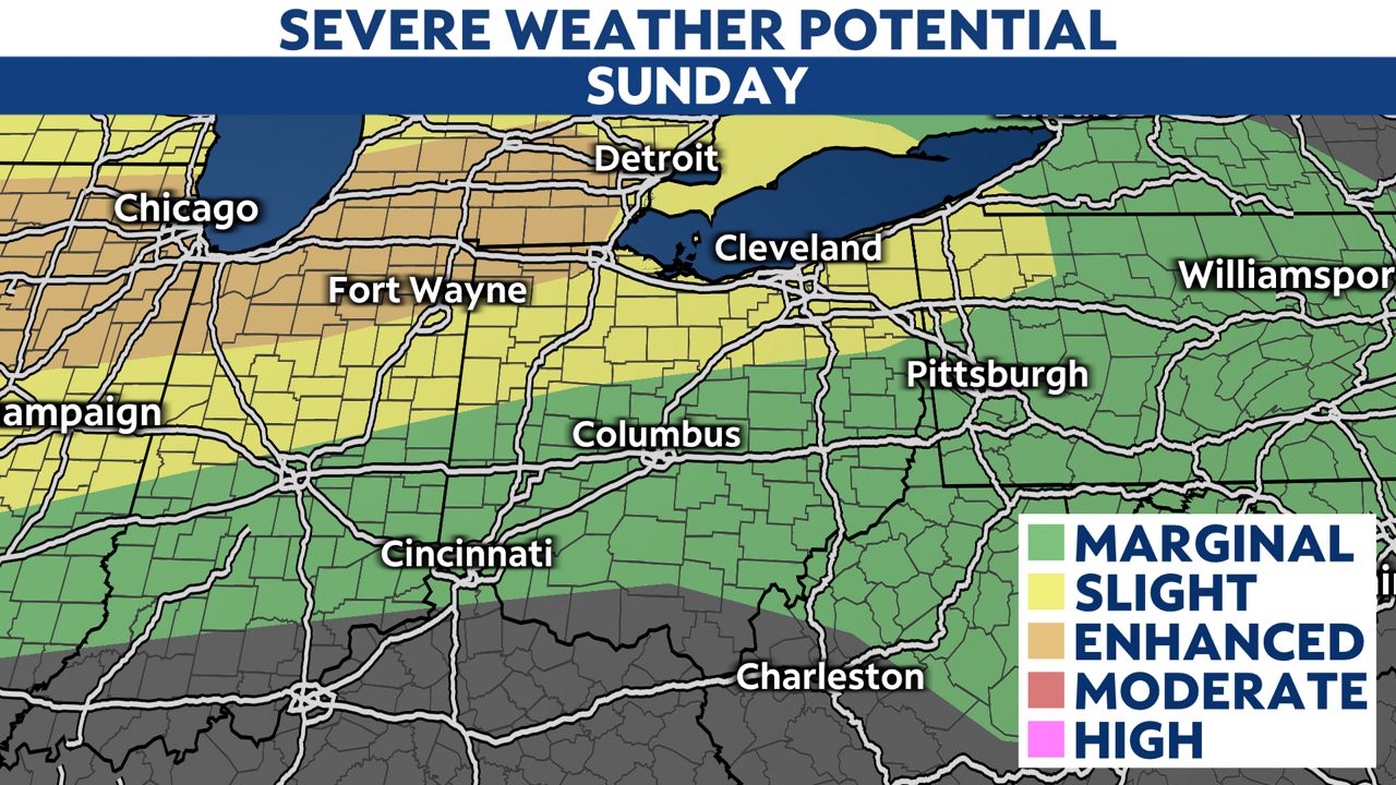
After a busy start to the weekend Friday night, Sunday will give us another chance for strong to severe storms, especially across northern Ohio.
An Enhanced Risk area clips Northwest Ohio, with likely damaging straight-line winds starting late afternoon (around 5 p.m.) into the evening hours before spreading into Northeast Ohio closer to 9-11 p.m.
The biggest issue will be wind gusts of 60+ mph, but hail and isolated tornadoes are also possible.
Additionally, flash flooding will be a possibility, with between 1-2+ inches coming down in a short period of time. Severe weather begins late afternoon, although isolated pop-ups are possible through the day Sunday.

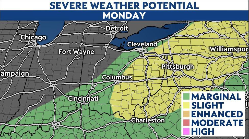
Monday concerns
With a powerful front moving through Monday, more severe weather is likely, especially across the eastern half of Ohio. With the fast movement of this system, damaging winds will be a big concern for us. We stay warm and very muggy, setting the stage for another round of severe weather, mostly damaging winds. Once again, a flooding threat persists, especially across Southeast Ohio.
Take a look at the severe weather potential for Monday:
The good news? If you were hoping for cooler and drier weather, just wait until the middle of next week. Behind the front, we’ll see plenty of sunshine and highs in some areas struggling to reach the low 70s!