High pressure, which has been in control of the weather across Ohio for much of the weekend, will weaken and shift back north. This will allow a front to the south of Ohio to move into the southern part of the state by Monday morning and slowly shift northward through Tuesday.
Scattered showers and a few storms will become likely across southern Ohio as the front moves in Monday morning. However, showers will struggle to lift into northern Ohio with high pressure still in some control over this region.
The front will weaken and continue to push north of Ohio by midweek, although little if any rain is expected along the front across northern Ohio as it moves by. Much warmer air will push into the region after the front moves through, pushing temperatures into the 80s by midweek.
It will feel much more like summer than late spring by the second half of the coming week.
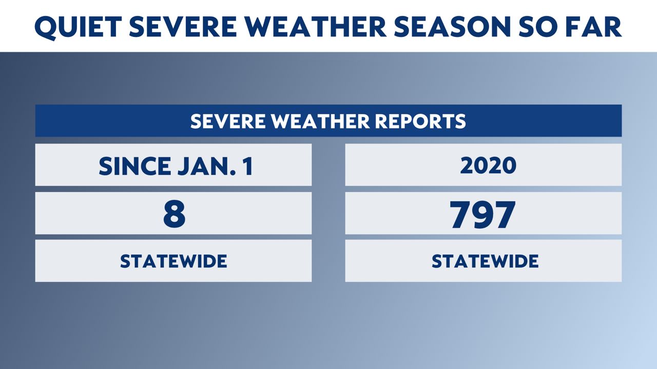
The entire state only has eight severe weather reports since January 1.
In 2020, the state had a total of 797 severe weather reports for the full year.
This does not mean we will get away without severe weather. Increasing heat and humidity next week could bring in some severe weather.