Today is the last mild day we will see for a while. Some scattered storms are moving in this morning and we will watch for some severe weather through this evening.
What You Need To Know
- Today is humid and mild with scattered storms
- Isolated severe weather is possible through tonight
- Much cooler air comes in for Wednesday
A few rounds of storms will come in ahead of a cold front later today. Most of the state is under a Marginal Risk for severe weather today (level 1 out of 5).
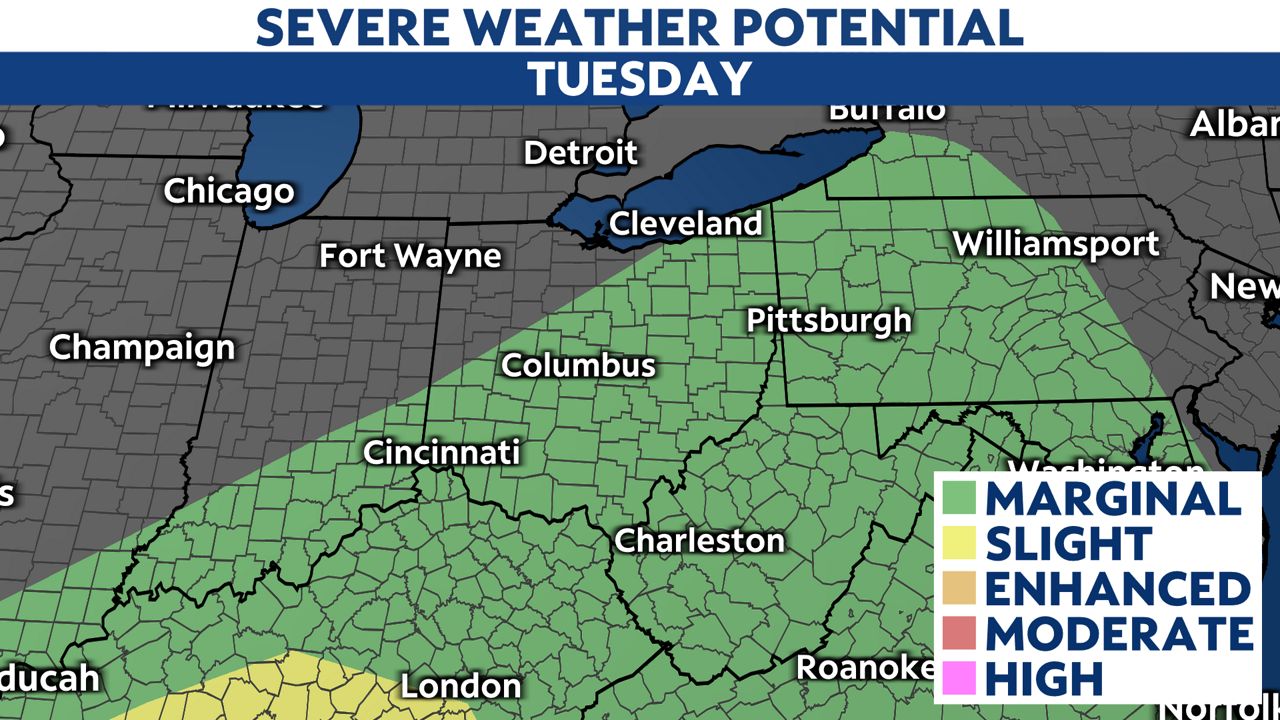
The main threats with severe weather today are large hail and damaging wind.
We will continue to see scattered showers overnight into early Wednesday.
Wednesday afternoon will be mainly dry but much cooler.
Look at our highs for tomorrow. In some cases this will be a 15-degree temperature drop.
-3)
We have a short time for dry weather from Wednesday afternoon through Thursday afternoon.
More rain moves in late Thursday into Friday.
A few rumbles of thunder will be possible late Thursday. More showers are possible late Saturday through Sunday so the rainy pattern is there at least until Monday.
Temperatures will stay cool and below average for the entire extended forecast (after today).
The polar jet will be influencing our weather pattern so no 80 degree days anytime soon!
Possible tornado Monday
Take a look at this photo!
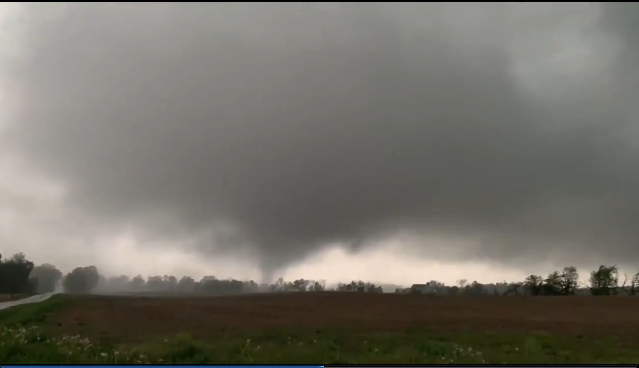
This is from video sent to us from Tyler Berry of Chasing Ohio.
This is from Mahoning county around 8:45 p.m. Monday.
The National Weather Service will determine if this is our first tornado touchdown of the season.
The storm became a tornado-warned storm as it moved east into Pennsylvania.